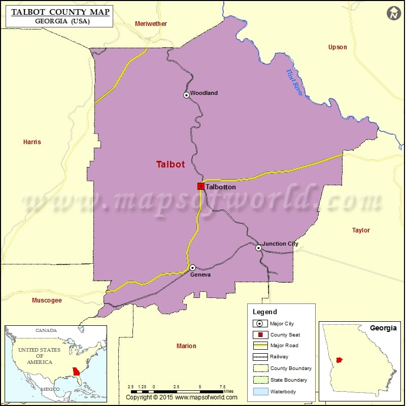
Georgia Counties Talbot County Map, Georgia Vishul MalikOctober 30, 202201.1K views Check this Georgia County Map to locate all the state’s counties in Georgia Map. Mountain Peaks in Talbot County Mountain Peak/Hill Elevation [Meter] Gulf Mountain 220 Rockhouse Mountain 324 Turkey Knob 300 Airports… Buy Printed MapBuy Digital MapWall MapsWall Maps Check this Georgia County Map to locate all the state’s counties in Georgia Map. Mountain Peaks in Talbot County Mountain Peak/Hill Elevation [Meter] Gulf Mountain 220 Rockhouse Mountain 324 Turkey Knob 300 Airports in Talbot County Airport Name C & W Air Park Jumpin J Airport Rainbow Field U S Naval Hospital San Diego Heliport Cities in Talbot County City Population Latitude Longitude Geneva town 105 32.578955 -84.551615 Junction City town 177 32.603166 -84.45735 Talbotton city 970 32.677268 -84.540594 Woodland city 408 32.787675 -84.56062

 Wall Maps