
 Wall Maps
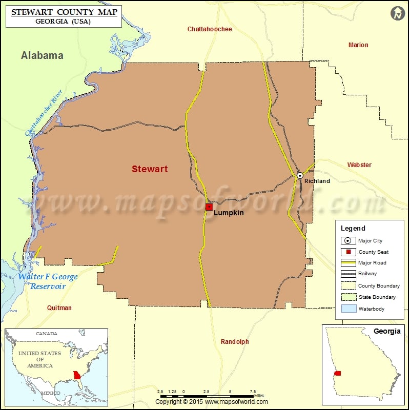
Check this Georgia County Map to locate all the state’s counties in Georgia Map.
Airports in Stewart County
| Airport Name |
|---|
| Raju Airport |
More Maps of Stewart County
Cities in Stewart County
| City | Population | Latitude | Longitude |
|---|---|---|---|
| Lumpkin city | 2741 | 32.048763 | -84.79803 |
| Richland city | 1473 | 32.08853 | -84.662565 |