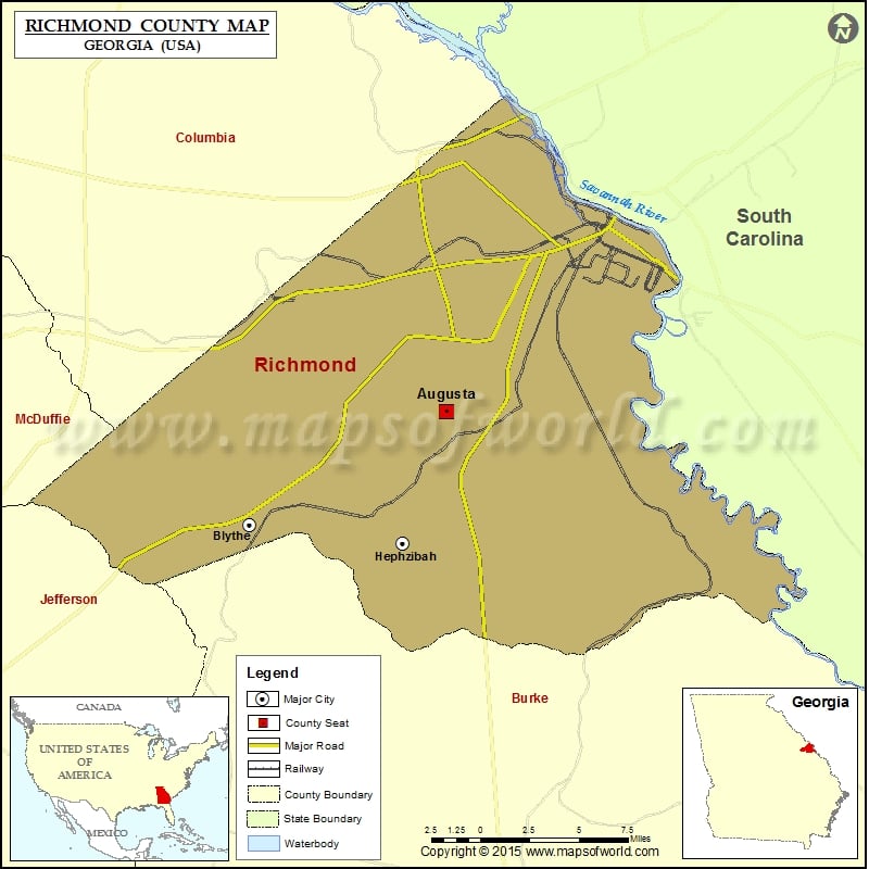
Richmond County Map, Georgia
Check this Georgia County Map to locate all the state’s counties in Georgia Map. Mountain Peaks in Richmond County Mountain Peak/Hill Elevation [Meter] Rhodes Mound 34 Whites Mound 33 More Maps of Richmond…
Check this Georgia County Map to locate all the state’s counties in Georgia Map .
Mountain Peaks in Richmond County
Mountain Peak/Hill
Elevation [Meter]
Rhodes Mound
34
Whites Mound
33
More Maps of Richmond County
Airports in Richmond County
Airport Name
Augusta Regional At Bush Field
Buckeye Municipal Airport
Daniel Field
Dwight David Eisenhower Army Medical Ctr Heliport
Medical College of Georgia Heliport
Mitchell’s Airport
St Joseph’s Hospital Heliport
Cities in Richmond County
City
Population
Latitude
Longitude
Augusta-Richmond County consolidated government (balance)
195844
33.364456
-82.07084
Blythe city
721
33.301136
-82.202655
Hephzibah city
4011
33.29073
-82.099463
Golf Courses in Richmond County
Name of Golf Course
Latitude
Longitude
Augusta Country Club-Augusta
33.482061
-82.010526
Augusta Municipal Golf Course-Augusta
33.484795
-82.029954
Augusta National Golf Club-Augusta
33.505633
-82.018142
Forest Hills Golf Club-Augusta
33.472944
-82.04678
Gordon Lakes Golf Course-Fort Gordon
33.40985
-82.154179
Goshen Plantation Golf Course-Augusta
33.333641
-81.989727
Green Meadows Golf Course-Augusta
33.420145
-82.039673
Pointe South Golf Club-Hephzibah
33.307213
-82.054731
The First Tee of Augusta-Augusta
33.468483
-82.049102

 Wall Maps