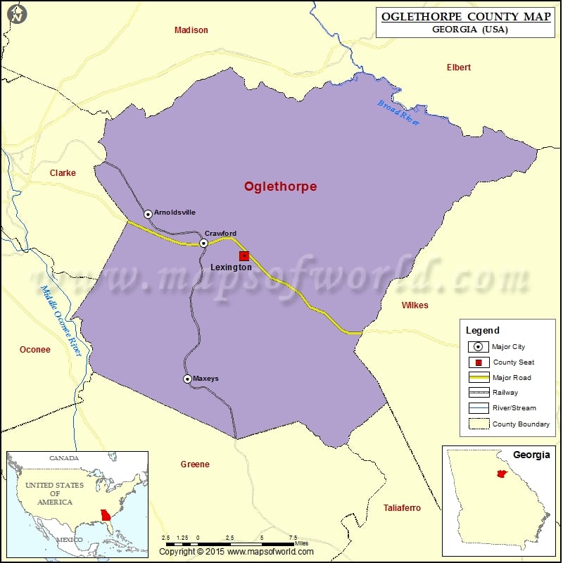
Georgia Counties Oglethorpe County Map, Georgia Vishul MalikOctober 29, 202201.2K views Check this Georgia County Map to locate all the state’s counties in Georgia Map. Mountain Peaks in Oglethorpe County Mountain Peak/Hill Elevation [Meter] Big Mountain 234 Airports in Oglethorpe County Airport Name Beaver… Buy Printed MapBuy Digital MapWall MapsWall Maps Check this Georgia County Map to locate all the state’s counties in Georgia Map. Mountain Peaks in Oglethorpe County Mountain Peak/Hill Elevation [Meter] Big Mountain 234 Airports in Oglethorpe County Airport Name Beaver Creek Lodge Heliport Cities in Oglethorpe County City Population Latitude Longitude Arnoldsville city 357 33.910329 -83.218058 Crawford city 832 33.883041 -83.155189 Lexington city 228 33.870069 -83.110154 Maxeys town 224 33.755482 -83.173699

 Wall Maps