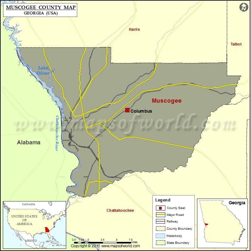
Muscogee County Map, Georgia
Check this Georgia County Map to locate all the state’s counties in Georgia Map. Mountain Peaks in Anderson County Mountain Peak/Hill Elevation [Meter] Clapp Hill 137 Watson Hill 116 Airports in Anderson County…
Check this Georgia County Map to locate all the state’s counties in Georgia Map .
Mountain Peaks in Anderson County
Mountain Peak/Hill
Elevation [Meter]
Clapp Hill
137
Watson Hill
116
Airports in Anderson County
Airport Name
Columbus Metropolitan Airport
Medical Center Heliport
Pratt and Whitney Aircraft Heliport
Tsa Gliderport
Cities in Anderson County
City
Population
Latitude
Longitude
Columbus city
189885
32.509961
-84.877041
Golf Courses in Anderson County
Name of Golf Course
Latitude
Longitude
Bull Creek Golf Course-Midland
32.553023
-84.840384
Country Club of Columbus-Columbus
32.487753
-84.964008
Godwin Creek Golf Course-Columbus
32.50291
-84.987457
Green Island Country Club-Columbus
32.539045
-85.002661
Maple Ridge Golf Club-Columbus
32.561923
-84.914903
Oxbow Creek Golf Course-Columbus
32.397302
-84.956033

 Wall Maps