
 Wall Maps
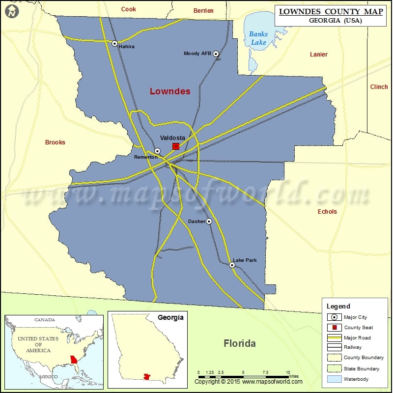
Check this Georgia County Map to locate all the state’s counties in Georgia Map.
Airports in Lowndes County
| Airport Name |
|---|
| Christians Folly Airport |
| Dufour Airport |
| Mallory Field |
| Mcclellan Airport |
| Moody Air Force Base |
| Shilo Farms Airport |
| Valdosta Regional Airport |
More Maps of Lowndes County
Cities in Lowndes County
| City | Population | Latitude | Longitude |
|---|---|---|---|
| Dasher town | 912 | 30.746248 | -83.225382 |
| Hahira city | 2737 | 30.993324 | -83.377487 |
| Lake Park city | 733 | 30.684995 | -83.187514 |
| Moody AFB | 886 | 30.978999 | -83.213855 |
| Remerton city | 1123 | 30.844142 | -83.308463 |
| Valdosta city | 54518 | 30.850327 | -83.278882 |
Golf Courses in Lowndes County
| Name of Golf Course | Latitude | Longitude |
|---|---|---|
| Francis Lake Golf Club-Lake Park | 30.677847 | -83.206736 |
| Kinderlou Forest Golf Club-Valdosta | 30.811451 | -83.378805 |
| Moody Quiet Pines Golf Course-Valdosta | 30.97951 | -83.215229 |
| Stone Creek Golf Club-Valdosta | 30.905954 | -83.345328 |
| Valdosta Country Club-Valdosta | 30.885269 | -83.306994 |