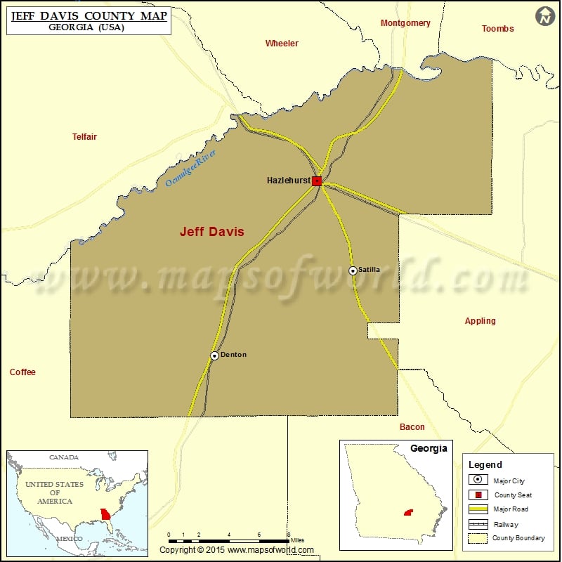
Georgia Counties Jeff Davis County Map, Georgia Vishul MalikOctober 28, 202201.2K views Check this Georgia County Map to locate all the state’s counties in Georgia Map. Airports in Jeff Davis County Airport Name Hazlehurst Airport More Maps of Jeff Davis County Jeff Davis County Map,… Buy Printed MapBuy Digital MapWall MapsWall Maps Check this Georgia County Map to locate all the state’s counties in Georgia Map. Airports in Jeff Davis County Airport Name Hazlehurst Airport More Maps of Jeff Davis County Jeff Davis County Map, Texas Cities in Jeff Davis County City Population Latitude Longitude Denton city 250 31.722137 -82.69676 Hazlehurst city 4226 31.865094 -82.599414 Satilla 421 31.792108 -82.56404 Golf Courses in Jeff Davis County Name of Golf Course Latitude Longitude Twisted Pine Golf Course-Hazlehurst 31.886044 -82.587711

 Wall Maps