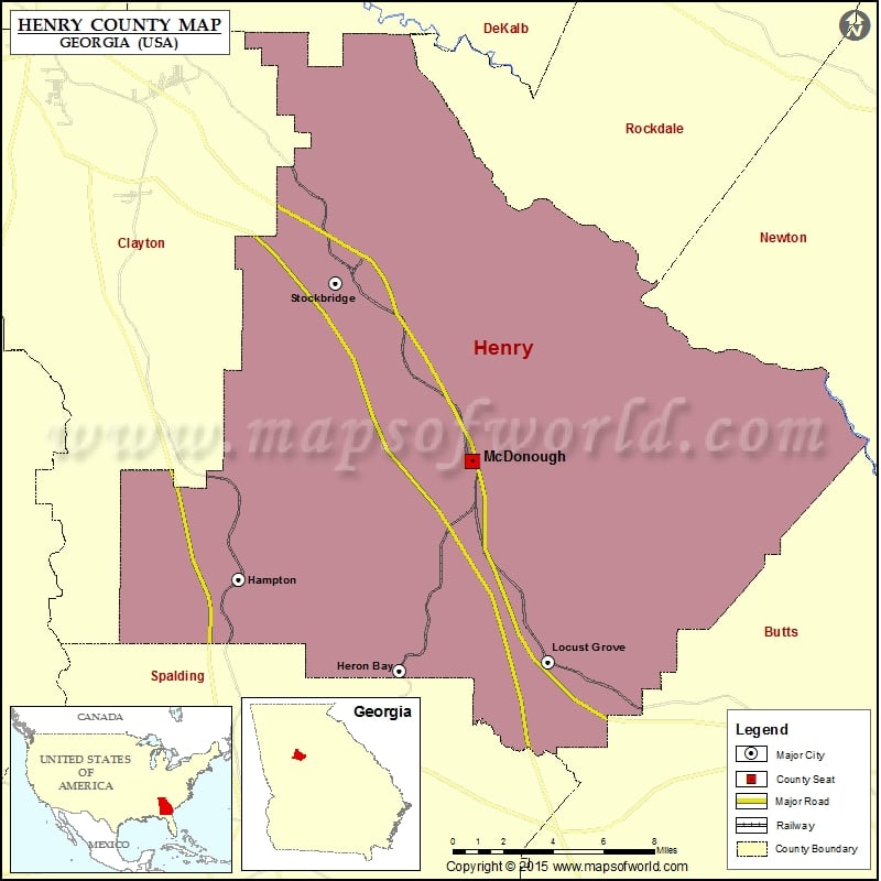
Henry County Map, Georgia
Check this Georgia County Map to locate all the state’s counties in Georgia Map. Airports in Henry County Airport Name Berry Hill Airport Clayton County Tara Field Deerfield Landing Airport Diamond S Airport…
Check this Georgia County Map to locate all the state’s counties in Georgia Map .
Airports in Henry County
Airport Name
Berry Hill Airport
Clayton County Tara Field
Deerfield Landing Airport
Diamond S Airport
Flying R Ranch Airport
Gorden E Bellah International Airport
Grant Airport
Henry Medical Center Inc Heliport
Holder’s Field
Mallards Landing Airport
More Maps of Henry County
Cities in Henry County
City
Population
Latitude
Longitude
Hampton city
6987
33.383245
-84.284705
Heron Bay
3384
33.339267
-84.192137
Locust Grove city
5402
33.343489
-84.106836
McDonough city
22084
33.440098
-84.150301
Stockbridge city
25636
33.526133
-84.228972
Golf Courses in Henry County
Name of Golf Course
Latitude
Longitude
Cannongate At Heron Bay-Locust Grove
33.33787
-84.192934
Canongate At Georgia National Golf Club-McDonough
33.448919
-84.074769
Cottonfields Golf Course-McDonough
33.41796
-84.166587
Crystal Lake Golf and Country Club-Hampton
33.458181
-84.249657
Eagle’s Brooke Golf and Country Club-Locust Grove
33.375227
-84.157025
Eagle’s Landing Country Club-Stockbridge
33.508626
-84.216936

 Wall Maps