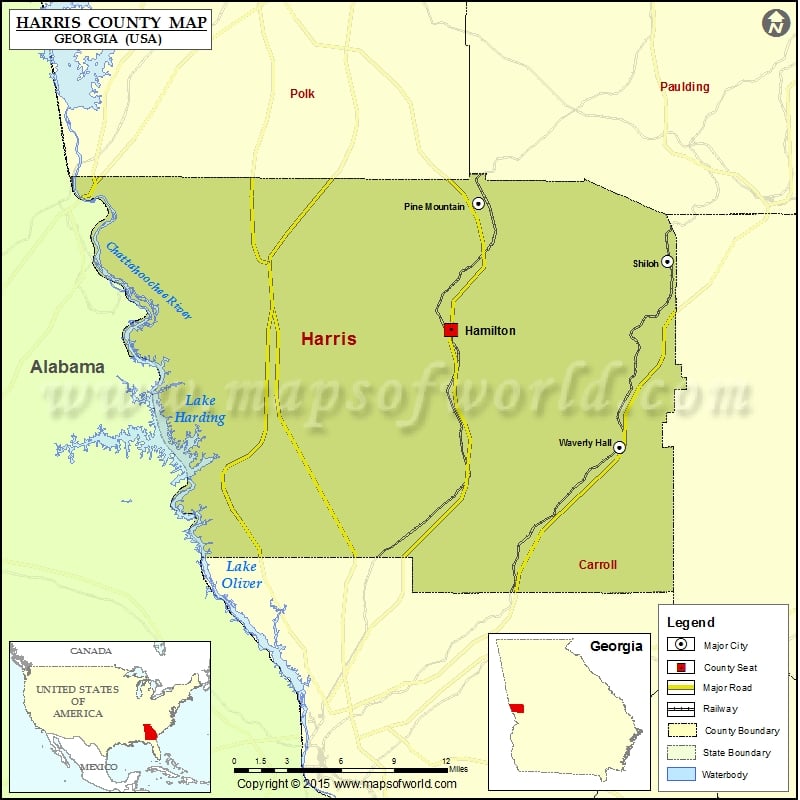
Check this Georgia County Map to locate all the state’s counties in Georgia Map. Mountain Peaks in Harris County Mountain Peak/Hill Elevation [Meter] Dowdell Knob 425 German Mountain 301 Oak Mountain 372 The…
Check this Georgia County Map to locate all the state’s counties in Georgia Map.
Mountain Peaks in Harris County
| Mountain Peak/Hill |
Elevation [Meter] |
| Dowdell Knob |
425 |
| German Mountain |
301 |
| Oak Mountain |
372 |
| The Mountain |
274 |
| Tip Top |
345 |
| Williams Mountain |
283 |
More Maps of Harris County
Airports in Harris County
| Airport Name |
| Geo H Lanier Memorial Hosp Heliport |
| Harris County Airport |
| Mclendon Field |
| Waverly Landing Airport |
Cities in Harris County
| City |
Population |
Latitude |
Longitude |
| Hamilton city |
1016 |
32.764516 |
-84.876039 |
| Pine Mountain town |
1304 |
32.852381 |
-84.853066 |
| Shiloh city |
445 |
32.811983 |
-84.69896 |
| Waverly Hall town |
735 |
32.683681 |
-84.737754 |
Golf Courses in Harris County
| Name of Golf Course |
Latitude |
Longitude |
| Callaway Gardens Golf Resort-Pine Mountain |
32.847405 |
-84.846096 |
| Woodlands Hills Golf Course-Midland |
32.587235 |
-84.812477 |

 Wall Maps