
 Wall Maps
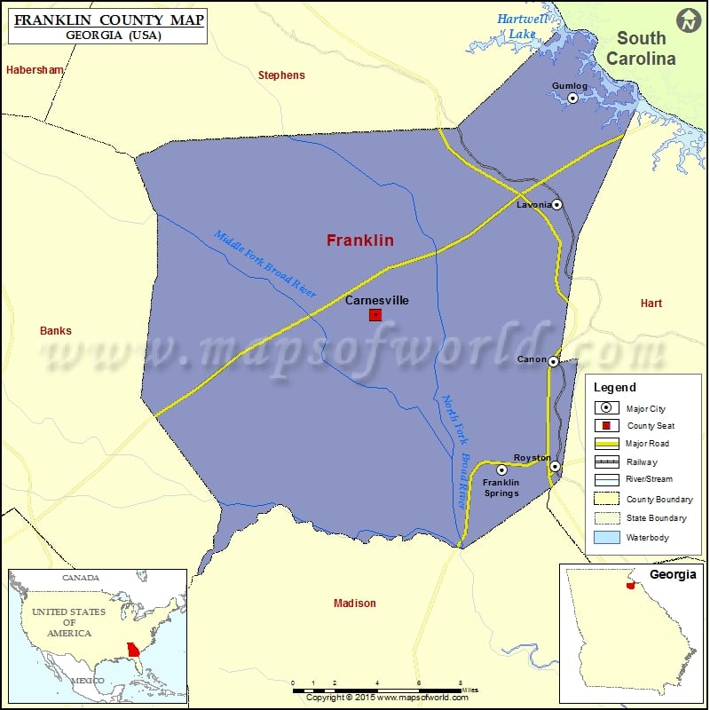
Check this Georgia County Map to locate all the state’s counties in Georgia Map.
Cities in Franklin County
| City | Population | Latitude | Longitude |
|---|---|---|---|
| Canon city | 804 | 34.345531 | -83.110737 |
| Carnesville city | 577 | 34.371584 | -83.23287 |
| Franklin Springs city | 952 | 34.284024 | -83.145899 |
| Gumlog | 2146 | 34.495044 | -83.097607 |
| Lavonia city | 2156 | 34.434408 | -83.108132 |
| Royston city | 2582 | 34.285951 | -83.109632 |
More Maps of Franklin County
- Franklin County Map, Vermont
- Franklin County Map, Nebraska
- Franklin County Map, Alabama
- Franklin County Map, Florida
- Franklin County Map, New York
- Franklin County Map, North Carolina
- Franklin County Map, Texas
- Franklin County Map, Tennessee
- Franklin County Map, Washington
Golf Courses in Franklin County
| Name of Golf Course | Latitude | Longitude |
|---|---|---|
| Highland Walk At Victoria Bryant-Royston | 34.291047 | -83.16215 |