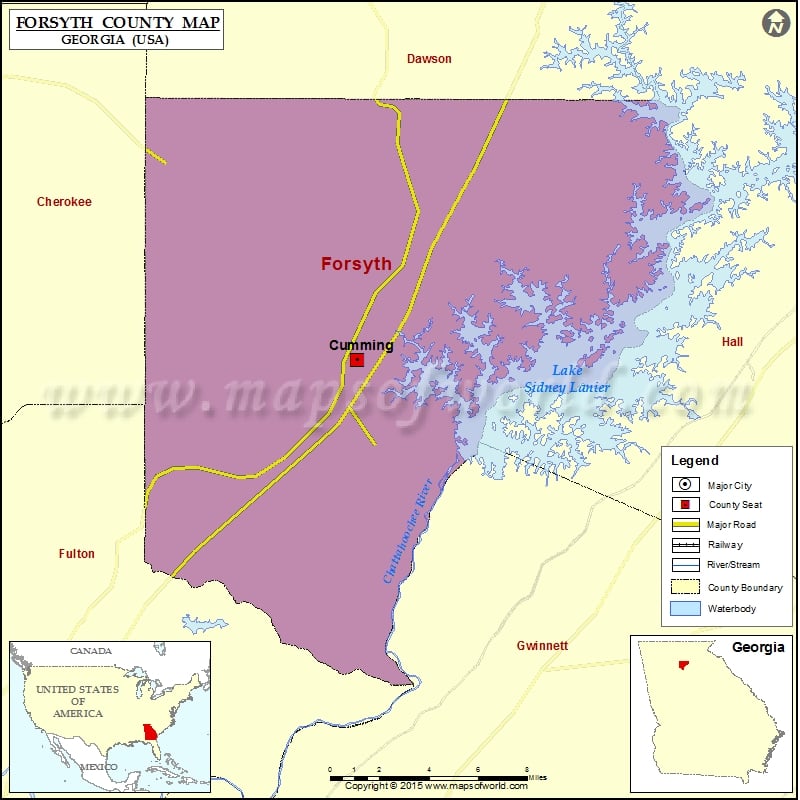
Check this Georgia County Map to locate all the state’s counties in Georgia Map. Mountain Peaks in Forsyth County Mountain Peak/Hill Elevation [Meter] Fox Hill 389 Sawnee Mountain 597 More Maps of Forsyth…
Check this Georgia County Map to locate all the state’s counties in Georgia Map.
Mountain Peaks in Forsyth County
| Mountain Peak/Hill |
Elevation [Meter] |
| Fox Hill |
389 |
| Sawnee Mountain |
597 |
More Maps of Forsyth County
Airports in Forsyth County
| Airport Name |
| Adams Heliport |
| Apple 1 Heliport |
| Beaver Trail Heliport |
| Ebeneezer Airport |
| Lanier Heliport |
| Mathis Airport |
| Mc Donald Heliport |
| Pinetree Heliport |
| Stoney Point Field |
Cities in Forsyth County
| City |
Population |
Latitude |
Longitude |
| Cumming city |
5430 |
34.207405 |
-84.134456 |
Golf Courses in Forsyth County
| Name of Golf Course |
Latitude |
Longitude |
| Canongate At Olde Atlanta Golf Club-Suwanee |
34.081439 |
-84.122386 |
| Country Land Golf Course-Cumming |
34.30268 |
-84.028669 |
| Hampton Golf Village-Cumming |
34.301001 |
-84.061271 |
| Lanier Golf Club-Cumming |
34.18127 |
-84.093867 |
| Laurel Springs Golf Club-Suwanee |
34.098943 |
-84.154458 |
| Polo Golf & Country Club-Cumming |
34.178516 |
-84.209272 |
| St Marlo Country Club-Duluth |
34.06742 |
-84.143302 |
| Windermere Golf Club-Cumming |
34.137716 |
-84.124684 |

 Wall Maps