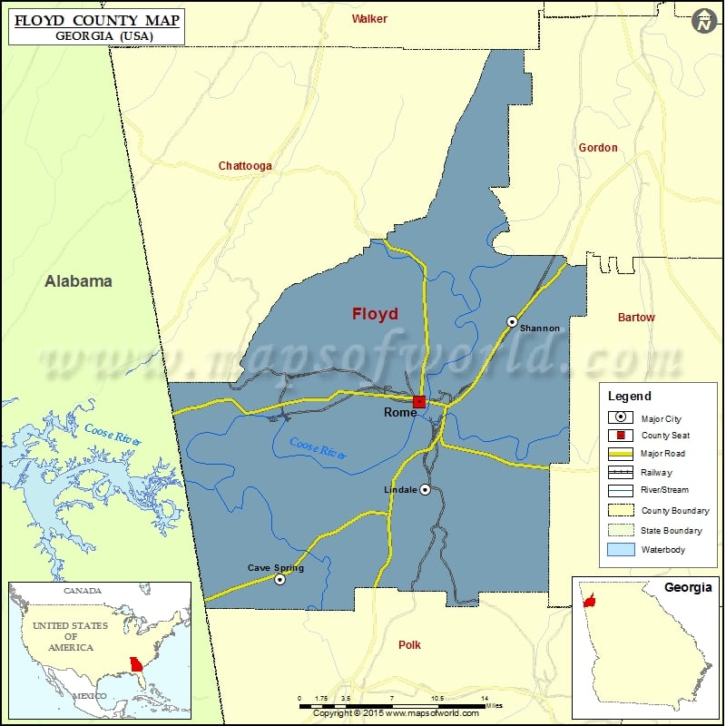
Floyd County Map, Georgia
Check this Georgia County Map to locate all the state’s counties in Georgia Map. Mountain Peaks in Floyd County Mountain Peak/Hill Elevation [Meter] Armstrong Mountain 355 Blossom Hill 238 Booze Mountain 302 Calbeck…
Check this Georgia County Map to locate all the state’s counties in Georgia Map .
Mountain Peaks in Floyd County
Mountain Peak/Hill
Elevation [Meter]
Armstrong Mountain
355
Blossom Hill
238
Booze Mountain
302
Calbeck Mountain
464
Carr Mountain
236
Heath Mountain
380
Hickory Mountain
325
Horseleg Mountain
404
Jackson Hill
227
Johns Mountain
513
Judy Mountain
246
Lavender Mountain
465
Lumpkin Hill
194
Mill Mountain
473
Mount Alto
459
Myrtle Hill
216
Old Shorter Hill
206
Oliver Mountain
229
Rock Mountain
422
Saddle Mountain
284
Tower Hill
210
Turkey Mountain
343
Walker Mountain
286
Ward Mountain
296
More Maps of Floyd County
Airports in Floyd County
Airport Name
Dawson Field
Richard B Russell Airport
Shannon Flight Strip
Wallace Field
Cities in Floyd County
City
Population
Latitude
Longitude
Cave Spring city
1200
34.106438
-85.339075
Lindale
4191
34.188177
-85.180799
Rome city
36303
34.267088
-85.187366
Shannon
1862
34.340621
-85.085355
Golf Courses in Floyd County
Name of Golf Course
Latitude
Longitude
Beckart Employees Athletic Association-Lindale
34.17134
-85.189601
Callier Springs Country Club-Rome
34.231408
-85.14407
Coosa Country Club-Rome
34.254099
-85.180264
Horseleg Plantation Country Club-Rome
34.226574
-85.21334
Kraftsmans Club-Rome
34.241064
-85.323146
Rabbit Run Golf Club-Adairsville
34.367657
-85.040388
Stonebridge Golf Club-Rome
34.338735
-85.192474

 Wall Maps