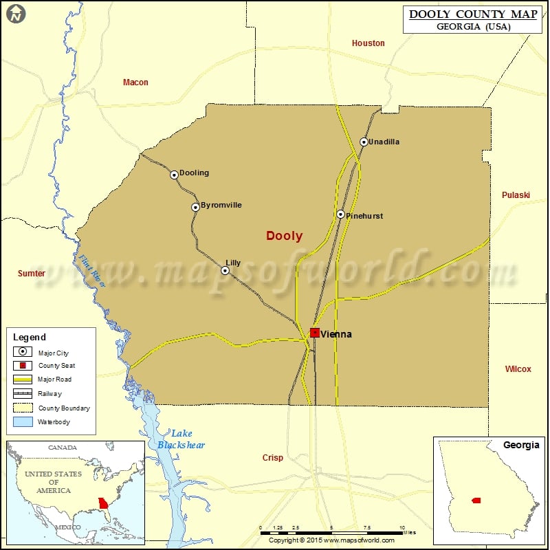
Georgia Counties Dooly County Map, Georgia Vishul MalikOctober 26, 202201.1K views Check this Georgia County Map to locate all the state’s counties in Georgia Map. Airports in Dooly County Airport Name Byromville Aerodrome Everidge Airport Flint River Nursery Airport Mack’s Field Roney Farms Airport… Buy Printed MapBuy Digital MapWall MapsWall Maps Check this Georgia County Map to locate all the state’s counties in Georgia Map. Airports in Dooly County Airport Name Byromville Aerodrome Everidge Airport Flint River Nursery Airport Mack’s Field Roney Farms Airport Snow Hill Airstrip Wrights Field Cities in Dooly County City Population Latitude Longitude Byromville town 546 32.201633 -83.907239 Dooling town 154 32.229976 -83.928924 Lilly city 213 32.146535 -83.877464 Pinehurst city 455 32.195568 -83.759655 Unadilla city 3796 32.258268 -83.735616 Vienna city 4011 32.092498 -83.78645

 Wall Maps