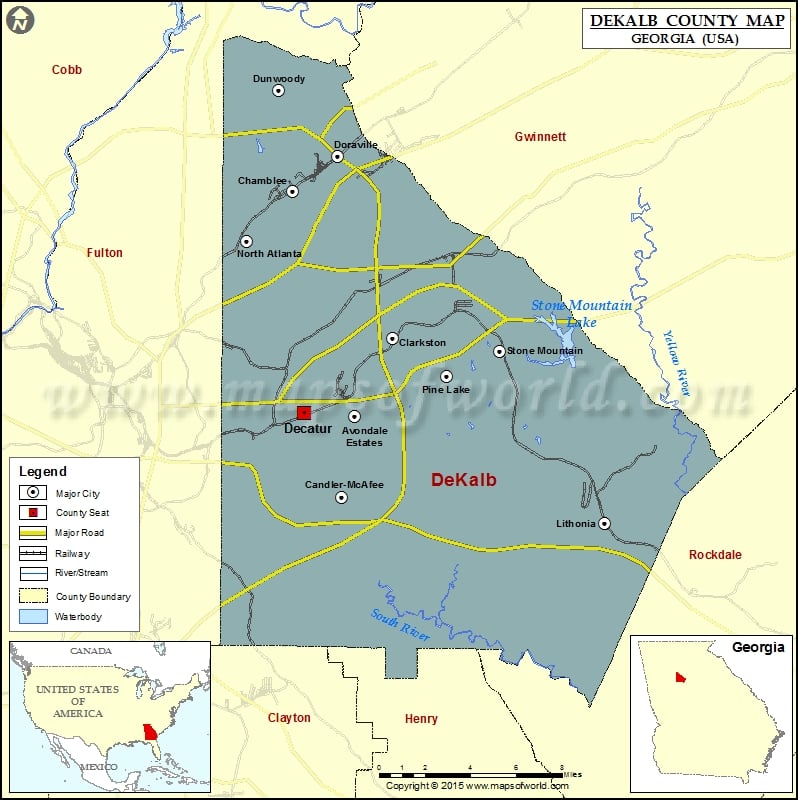
DeKalb County Map, Georgia
Check this Georgia County Map to locate all the state’s counties in Georgia Map. Mountain Peaks in DeKalb County Mountain Peak/Hill Elevation [Meter] Arabia Mountain 290 Elijah Mountain 278 Leggett’s Hill 318 Pine…
Check this Georgia County Map to locate all the state’s counties in Georgia Map .
Mountain Peaks in DeKalb County
Mountain Peak/Hill
Elevation [Meter]
Arabia Mountain
290
Elijah Mountain
278
Leggett’s Hill
318
Pine Mountain
323
Rock Chapel Mountain
286
Stone Mountain
512
More Maps of DeKalb County
Airports in DeKalb County
Airport Name
Brushy Creek Airport
DeKalb Peachtree Airport
Dekalb Police Dept Heliport
Egleston Hospital Heliport
Emory University Hospital Heliport
Georgia Bureau of Investigation Heliport
Lt World Airport
Spencer Field
Stone Mountain Park Public Safety Heliport
Stone Mountain Park Skylift Heliport
Trico Heliport
Williams Heliport
Cities in DeKalb County
City
Population
Latitude
Longitude
Avondale Estates city
2960
33.769387
-84.26426
Belvedere Park
15152
33.748913
-84.260037
Candler-McAfee
23025
33.726719
-84.272465
Chamblee city
9892
33.888666
-84.303623
Clarkston city
7554
33.81064
-84.240272
Decatur city
19335
33.771215
-84.296753
Doraville city
8330
33.90679
-84.275012
Druid Hills
14568
33.787449
-84.325974
Dunwoody city
46267
33.941878
-84.31236
Gresham Park
7432
33.705305
-84.315518
Lithonia city
1924
33.712953
-84.106001
North Atlanta
40456
33.862227
-84.332546
North Decatur
16698
33.806955
-84.288721
North Druid Hills
18947
33.819005
-84.326053
Panthersville
9749
33.705922
-84.276321
Pine Lake city
730
33.79051
-84.206029
Redan
33015
33.737593
-84.158916
Scottdale
10631
33.795413
-84.262627
Stone Mountain city
5802
33.80382
-84.172036
Tucker
27581
33.853263
-84.222863
Golf Courses in DeKalb County
Name of Golf Course
Latitude
Longitude
Candler Park Golf Course-Atlanta
33.769267
-84.339194
Charlie Yates Golf Course-Atlanta
33.743733
-84.314837
Druid Hills Golf Club-Atlanta
33.774403
-84.330766
East Lake Golf Club-Atlanta
33.744972
-84.303353
Mystery Valley Golf Course-Lithonia
33.758223
-84.145066
Peachtree Golf Club-Atlanta
33.875576
-84.327776
Smoke Rise Golf & Country Club-Stone Mountain
33.838679
-84.186854
Southland Country Club-Stone Mountain
33.774937
-84.155625
Stone Mountain Golf Club-Stone Mountain
33.817089
-84.129265
Sugar Creek Golf Course-Atlanta
33.681337
-84.308453

 Wall Maps