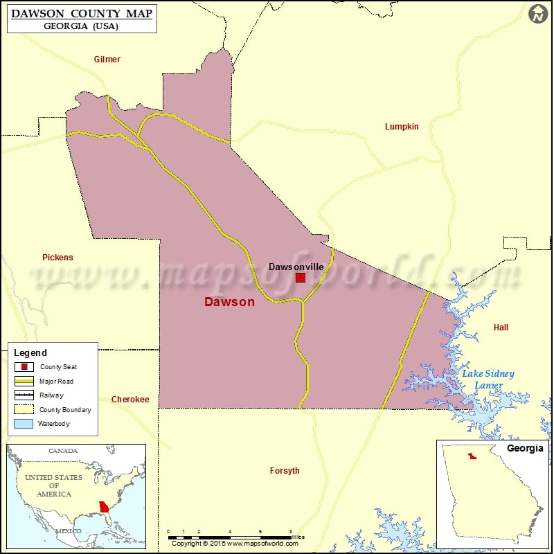
Check this Georgia County Map to locate all the state’s counties in Georgia Map. Democratic Party Candidates Total Votes % Votes Hillary Clinton 312 52.97% Bernie Sanders 268 45.50% Others 9 1.53% More…
Check this Georgia County Map to locate all the state’s counties in Georgia Map.
| Candidates |
Total Votes |
% Votes |
| Hillary Clinton |
312 |
52.97% |
| Bernie Sanders |
268 |
45.50% |
| Others |
9 |
1.53% |
More Maps of Dawson County
Mountain Peaks in Dawson County
| Mountain Peak/Hill |
Elevation [Meter] |
| Frosty Mountain |
1033 |
| Grogan Mountain |
597 |
| McElroy Mountain |
673 |
| Sanderlin Mountain |
911 |
| Wet Mountain |
756 |
Airports in Dawson County
| Airport Name |
| Elliott Field |
| Foothills-Holcomb Airport |
Cities in Dawson County
| City |
Population |
Latitude |
Longitude |
| Dawsonville city |
2536 |
34.436913 |
-84.124155 |
Golf Courses in Dawson County
| Name of Golf Course |
Latitude |
Longitude |
| Chestatee Golf Club-Dawsonville |
34.403198 |
-83.983041 |
| Crystal Falls Golf Club-Dawsonville |
34.371707 |
-84.238998 |
| Gold Creek Golf Resort & Conference Center-Dawsonville |
34.455445 |
-84.106271 |

 Wall Maps