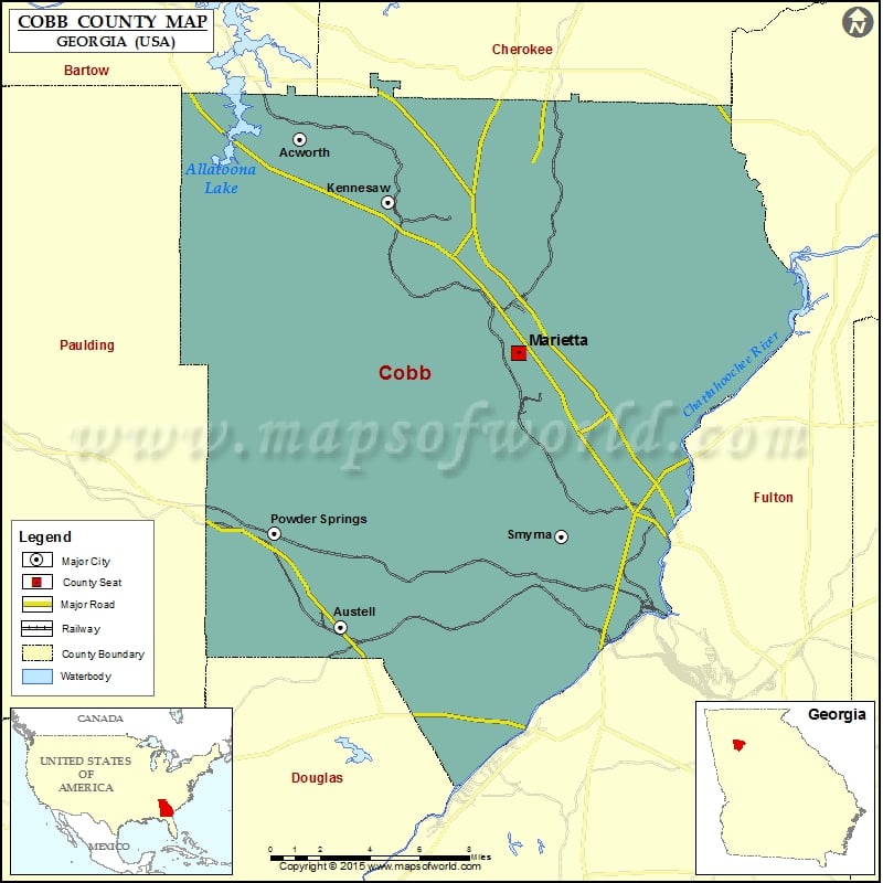
Check this Georgia County Map to locate all the state’s counties in Georgia Map. Mountain Peaks in Cobb County Mountain Peak/Hill Elevation [Meter] Blackjack Mountain 418 Cheatham Hill 342 Kennesaw Mountain 543 Little…
Check this Georgia County Map to locate all the state’s counties in Georgia Map .
Mountain Peaks in Cobb County
Mountain Peak/Hill
Elevation [Meter]
Blackjack Mountain
418
Cheatham Hill
342
Kennesaw Mountain
543
Little Kennesaw Mountain
488
Lost Mountain
462
Mount Wilkinson
299
Pigeon Hill
379
Pine Mountain
399
Sweat Mountain
500
Airports in Cobb County
Airport Name
Calhoun Heliport
Cobb County-McCollum Field
Cobb General Hospital Heliport
Dobbins Air Reserve Base Airport
Galleria Heliport
Interstate North Heliport
Kennestone Heliport
Matthews Heliport
Smyrna Hospital Heliport
Cities in Cobb County
City
Population
Latitude
Longitude
Acworth city
20425
34.056425
-84.668881
Austell city
6581
33.820256
-84.645307
Fair Oaks
8225
33.919304
-84.544439
Kennesaw city
29783
34.026275
-84.617785
Mableton
37115
33.813222
-84.565409
Marietta city
56579
33.953164
-84.542016
Powder Springs city
13940
33.865945
-84.683699
Smyrna city
51271
33.864095
-84.516861
Vinings
9734
33.860786
-84.468615
Golf Courses in Cobb County
Name of Golf Course
Latitude
Longitude
Atlanta Country Club-Marietta
33.939104
-84.422762
Brookstone Country Club-Acworth
33.994119
-84.723693
City Club Marietta-Marietta
33.942082
-84.552114
Cobblestone Golf Club-Acworth
34.045301
-84.666969
Dogwood Golf & Country Club-Austell
33.850935
-84.631952
Fox Creek Golf Club-Smyrna
33.894626
-84.510112
Indian Hills Country Club-Marietta
33.960959
-84.435417
Legacy Golf Links Windy Hill-Smyrna
33.896651
-84.498607
Marietta Country Club-Kennesaw
33.986874
-84.624126
Pinetree Country Club-Kennesaw
34.035405
-84.59205
The Governor’s Towne Club-Acworth
34.063663
-84.730511
National Parks in Cobb County
Name of Park
Latitude
Longitude
Chattahoochee River NRA
33.986171
-84.372118
Chattahoochee River NRA
33.920187
-84.417107
Kennesaw Mountain NBP
33.952762
-84.59318

 Wall Maps