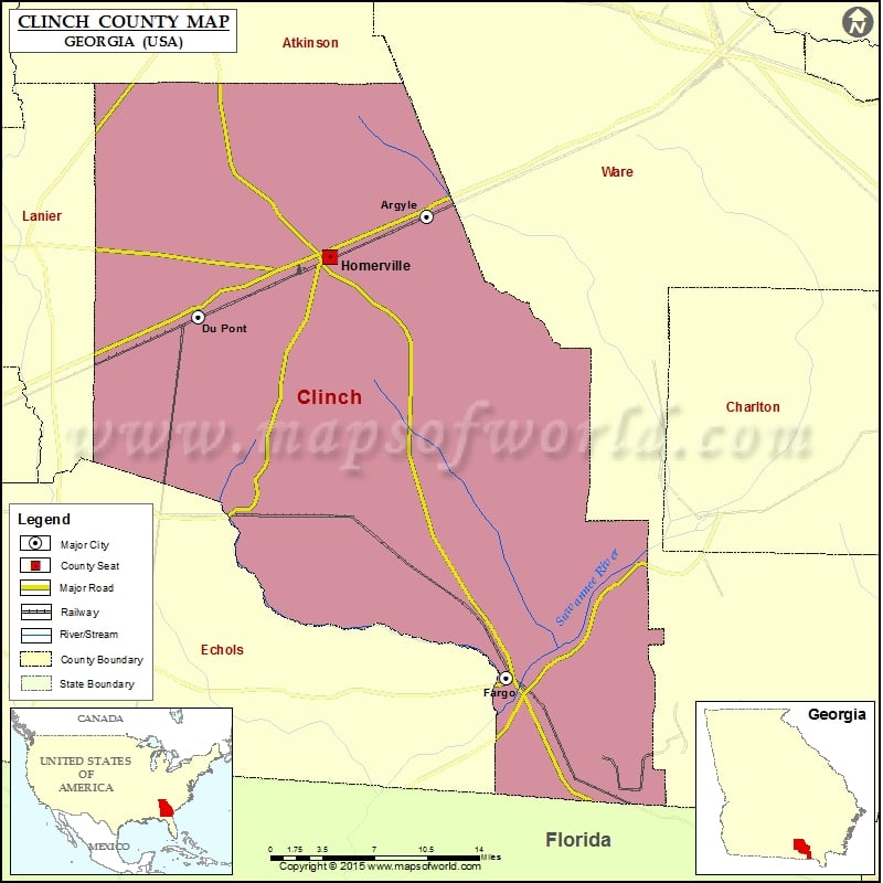
Georgia Counties Clinch County Map, Georgia Vishul MalikOctober 26, 202201.1K views Check this Georgia County Map to locate all the state’s counties in Georgia Map. Mountain Peaks in Clinch County Mountain Peak/Hill Elevation [Meter] Bird Sand Hill 41 Airports in Clinch County Airport Name… Buy Printed MapBuy Digital MapWall MapsWall Maps Check this Georgia County Map to locate all the state’s counties in Georgia Map. Mountain Peaks in Clinch County Mountain Peak/Hill Elevation [Meter] Bird Sand Hill 41 Airports in Clinch County Airport Name Fargo Airport Homerville Airport Cities in Clinch County City Population Latitude Longitude Argyle town 212 31.073214 -82.648875 Du Pont town 120 30.989096 -82.869085 Fargo city 321 30.688075 -82.572056 Homerville city 2456 31.038577 -82.741958 Golf Courses in Clinch County Name of Golf Course Latitude Longitude Fargo Golf Course-Fargo 30.69041 -82.563212

 Wall Maps