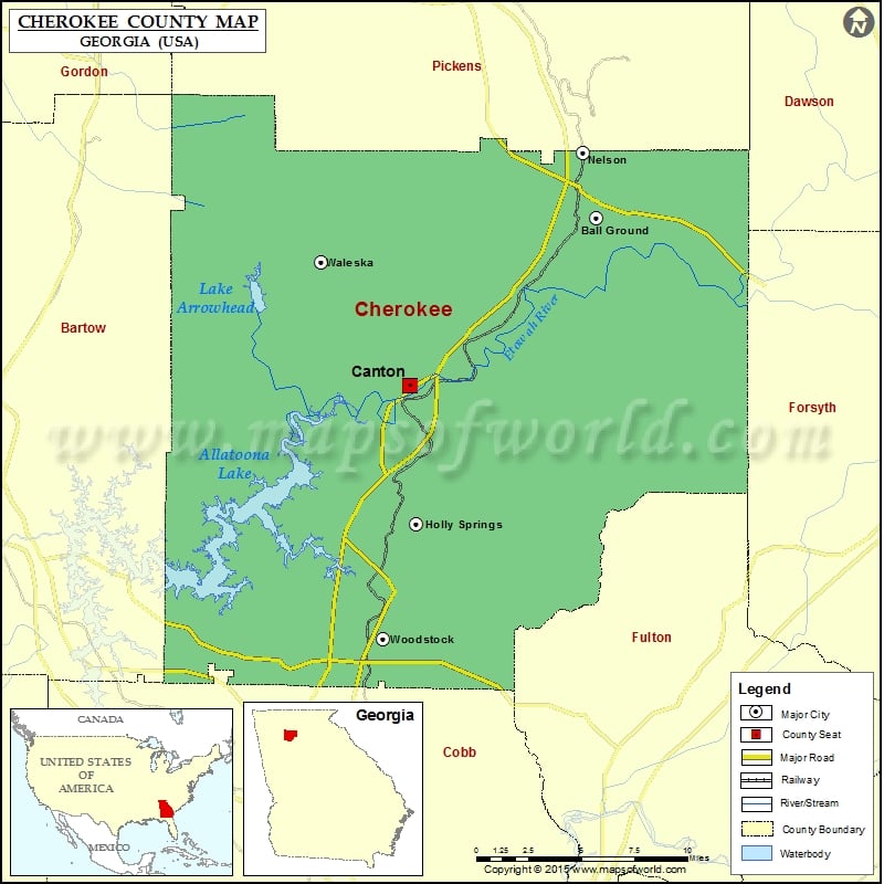
Cherokee County Map, Georgia
Check this Georgia County Map to locate all the state’s counties in Georgia Map. Mountain Peaks in Cherokee County Mountain Peak/Hill Elevation [Meter] Bear Mountain 699 Byrd Mountain 414 Dry Pond Mountain 501…
Check this Georgia County Map to locate all the state’s counties in Georgia Map .
Mountain Peaks in Cherokee County
Mountain Peak/Hill
Elevation [Meter]
Bear Mountain
699
Byrd Mountain
414
Dry Pond Mountain
501
Garland Mountain
410
Hickory Log Mountain
472
Pine Log Mountain
690
Polecat Mountain
458
Posey Mountain
399
More Maps of Cherokee County
Airports in Cherokee County
Airport Name
Air Acres Airport
Cherokee County Airport
Chukkar Farm Ultralightport
Dick Dale Skyranch Airport
East Valley Sheriff’s Station Heliport
Hawks Ridge Heliport
Holly Farm Airport
Pegasus Run Airport
Cities in Cherokee County
City
Population
Latitude
Longitude
Ball Ground city
1433
34.342028
-84.361936
Canton city
22958
34.246824
-84.490177
Holly Springs city
9189
34.168012
-84.485156
Nelson city
1314
34.37935
-84.370997
Waleska city
644
34.317014
-84.550556
Woodstock city
23896
34.102657
-84.50828
Golf Courses in Cherokee County
Name of Golf Course
Latitude
Longitude
Ansley Golf Club At Settindown Creek-Roswell
34.10005
-84.418626
Bradshaw Farm Golf Club-Woodstock
34.153628
-84.444499
Bridgemill Athletic Club-Canton
34.186821
-84.549735
Callahan Golf Links-Waleska
34.301978
-84.523109
Canongate At Eagle Watch Golf Club-Woodstock
34.136649
-84.557413
Canongate At Laurel Canyon-Canton
34.267802
-84.517962
Canton Golf Club-Canton
34.230723
-84.47568
Capital City Club Crabapple-Woodstock
34.129796
-84.366605
Cherokee Golf Center-Woodstock
34.077594
-84.540745
Echelon Golf Club-Alpharetta
34.190387
-84.301801
Hawks Ridge Golf Club-Ball Ground
34.258416
-84.273129
Lake Arrowhead Resort & Country Club-Waleska
34.296596
-84.599513
Towne Lake Hills Golf Club-Woodstock
34.117754
-84.553596
Woodmont Golf Club-Canton
34.232925
-84.355462

 Wall Maps