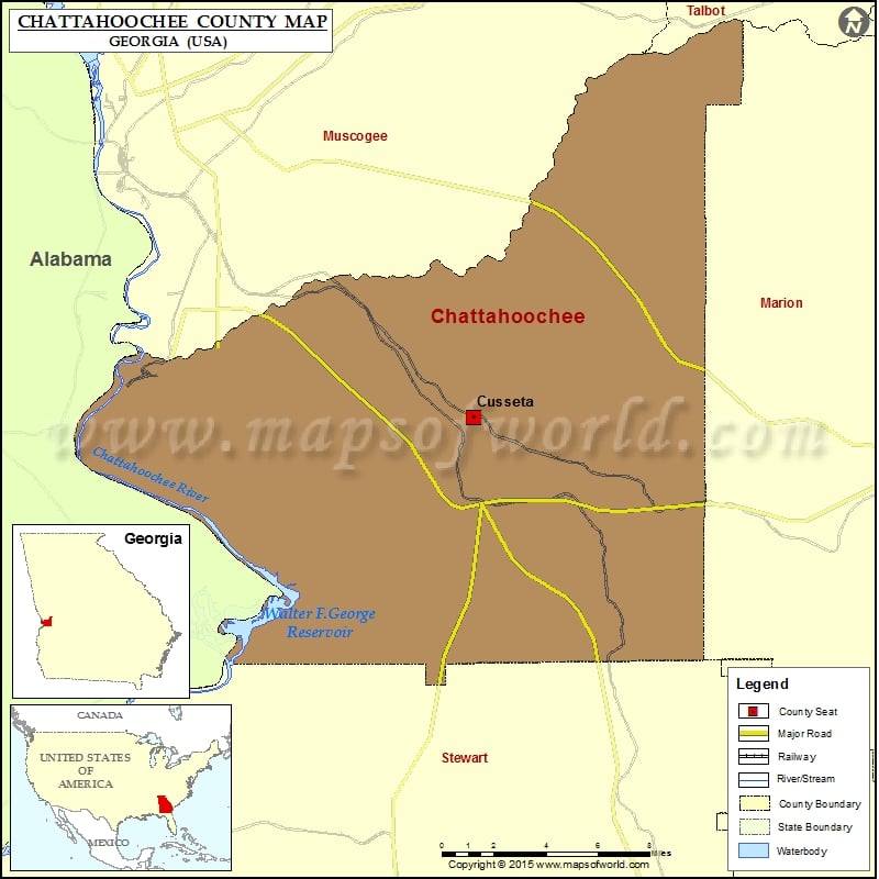
Chattahoochee County Map, Georgia
Check this Georgia County Map to locate all the state’s counties in Georgia Map. Mountain Peaks in Chattahoochee County Mountain Peak/Hill Elevation [Meter] Acheson Hill 94 Anderson Hill 114 Bailey Hill 104 Bardman…
Check this Georgia County Map to locate all the state’s counties in Georgia Map .
Mountain Peaks in Chattahoochee County
Mountain Peak/Hill
Elevation [Meter]
Acheson Hill
94
Anderson Hill
114
Bailey Hill
104
Bardman Hill
123
Bomford Hill
104
Bouton Hill
129
Breckenridge Hill
79
Buma Hill
120
Burks Hill
99
Bush Hill
212
Carson Hill
93
Cleveland Hill
123
Coacher Hill
128
Colyer Hill
138
Conrad Hill
117
Cope Hill
93
Craig Hill
122
Craston Hill
120
Cunningham Hill
114
Davidson Hill
139
Davis Hill
148
Delario Hill
87
Detrow Hill
131
Ebbert Hill
137
Elliott Hill
132
Gow Hill
147
Gray Hill
112
Green Hill
138
Griswold Hill
127
Hamilton Hill
117
Hawkinson Hill
116
Herman Hill
124
Hess Hill
101
Higley Hill
132
Holliday Hill
140
Humphreys Hill
129
Hutchcraft Hill
99
Jobes Hill
123
Jordan Hill
132
Journey Hill
132
Lambert Hill
127
Lee Hill
126
Long Hill
134
Lyons Hill
98
Mason Hill
101
McClusky Hill
108
McKenna Hill
131
McLaughlin Hill
120
Minter Hill
99
Montgomery Hill
92
Norwat Hill
104
Oliver Hill
123
Owens Hill
102
Powell Hill
99
Ray Hill
126
Redwood Hill
102
Reeve Hill
97
Reynolds Hill
120
Riche Hill
126
Rivet Hill
127
Rockwell Hill
143
Rockwood Hill
92
Ross Hill
99
Rowan Hill
144
Ryans Hill
121
Selby Hill
141
Singleton Hill
135
Smith Hill
129
Smyth Hill
125
Stevenson Hill
95
Tally Hill
108
Thompson Hill
107
Torrell Hill
132
Toy Hill
129
Tubbs Hill
98
Turner Hill
136
Vanvoris Hill
90
Wadsworth Hill
147
Walter Hill
131
Wells Hill
123
Winstead Hill
145
Woodward Hill
120
Airports in Chattahoochee County
Airport Name
Lawson Army Air Field (Fort Benning)
Cities in Chattahoochee County
City
Population
Latitude
Longitude
Cusseta-Chattahoochee County unified government
11267
32.346972
-84.78705
Golf Courses in Chattahoochee County
Name of Golf Course
Latitude
Longitude
Red Oak Golf Club-Cusseta
32.28772
-84.751535
The Fort Benning Golf Club-Fort Benning
32.359015
-84.946007

 Wall Maps