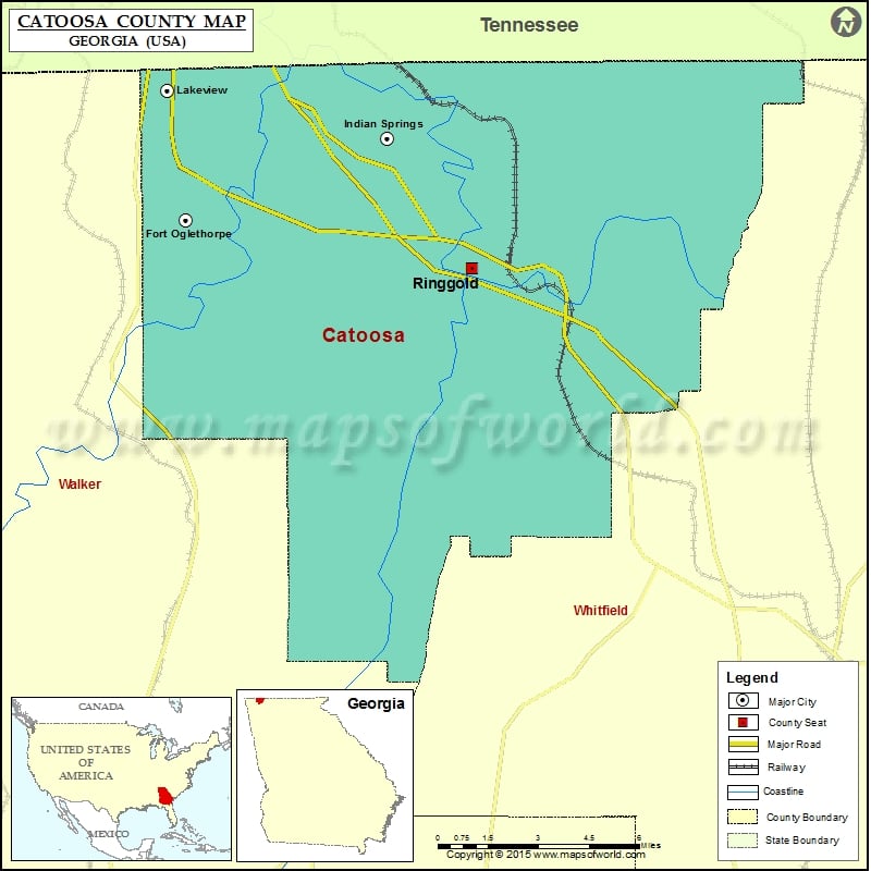
Catoosa County Map, Georgia
Check this Georgia County Map to locate all the state’s counties in Georgia Map. Mountain Peaks in Catoosa County Mountain Peak/Hill Elevation [Meter] Beaumont Mountain 337 Belmont Mountain 332 Bermuda Hill 291 Boynton…
Check this Georgia County Map to locate all the state’s counties in Georgia Map .
Mountain Peaks in Catoosa County
Mountain Peak/Hill
Elevation [Meter]
Beaumont Mountain
337
Belmont Mountain
332
Bermuda Hill
291
Boynton Ridge
274
Dailey Hill
254
Happy Top
280
Sand Mountain
408
White Oak Mountain
344
White Oak Mountain
374
Airports in Catoosa County
Airport Name
Catoosa Springs STOLport
Flying G Ranch Airport
Wilson Airport
Cities in Catoosa County
City
Population
Latitude
Longitude
Fort Oglethorpe city
9263
34.93184
-85.246029
Indian Springs
2241
34.960544
-85.159162
Lakeview
4839
34.97768
-85.253813
Ringgold city
3580
34.914778
-85.122414
Golf Courses in Catoosa County
Name of Golf Course
Latitude
Longitude
Battlefield Golf Club Inc-Ringgold
34.926605
-85.228668
Council Fire Golf Club-Chattanooga
34.98653
-85.172877
Windstone Golf Club-Ringgold
34.98017
-85.118029
National Parks in Catoosa County
Name of Park
Latitude
Longitude
Chickamauga and Chattanooga NMP
34.919114
-85.254459

 Wall Maps