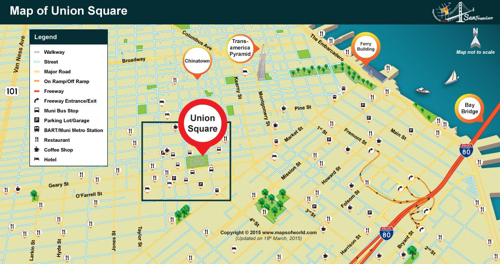
This is a detailed map that shows location of Union Square in San Francisco. You can use it to understand how you can reach Union Square using Interstate 80, the map also shows the nearest Restaurants, Hotels, Parking and BART/Muni Stations to Union Square.
Union Square Map, San Francisco
This is a detailed map that shows location of Union Square in San Francisco. You can use it to understand how you can reach Union Square using Interstate 80, the map also…