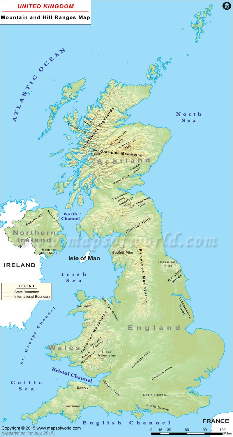
The United Kingdom is located in Western Europe. The United Kingdom comprises four countries England, Wales, Scotland, and Northern Ireland. The country covers an area of 94,060 square miles which includes varied flora and fauna, cities, valleys, lakes, mountains, etc. The UK is home to a number of mountains but many of the tallest peaks are situated in Scotland. It has been estimated that 56 of the highest mountains of the European nation are situated in Scotland.
The UK Mountain Map shows Ben Nevis, which is the highest mountain in the country. It has a height of 1,345 meters. The mountain, which is a famous tourist destination, is situated in the Scottish Highlands. Ben Macdui is the second highest mountain and is situated in Scotland. This mountain has a height of 1,309 meters. Some other mountains in Scotland are Braeriach, Cairn Toul, Sgor an Lochain Uaine, Cairn Gorm, Aonach Beag, Carn Mor Dearg, Aonach Mor, Ben Lawers, etc.
Wales is largely mountainous and is home to some very high peaks. With a height of 1,085 meters, Snowdown is the highest mountain in Wales. It is also the highest point in the British Isle, outside of Scotland. The second highest mountain in Wales is Carnedd Llewelyn with a height of 1,064 meters, while Glyder Fawr is the third and has a height of 1,001 meters. The other mountains in Wales are Y Garn, Elidir, Fawr, Tryfan, Aran Fawddwy, Y Lliwedd, Cadair Idris, Pen y Fan, etc.
Scafell Pike, with a height of 978 meters, is the highest mountain in England. Situated in the Lake District National Park in Cumbria, is a famous tourist attraction and is frequented by walkers. There are many other mountains in England such as Helvellyn, Skiddaw, Great Gable, Cross Fell, Pillar, and Fair Field, to name a few.
The highest mountain in Northern Ireland is Slieve Donard, which has a height of 850 meters. Some other mountains located here are Slieve Commedagh, Slieve Binnian, Slieve Bearnagh, and Sawel Mountain, among others.
The UK Mountain Map depicts the various mountains located in the country. The map also shows the international boundary, the neighboring nation of Ireland, and the Atlantic Ocean, North Sea, Irish Sea, etc.
