- Tanzania Cties - Arusha, Bagamoyo, Bukoba, Dar es Salaam, Dodoma, Geita, Isoko, Kigoma, Iringa, Mbeya, Morogoro, Moshi, Musoma, Mwanza, Seronera, Shinyanga, Songea, Tabora, Tanga, Zanzibar
- Neighboring Countries - Rwanda, Burundi, Malawi, Uganda, Kenya, DRC
- Continent And Regions - Africa Map
- Other Tanzania Maps - Tanzania Map, Tanzania Blank Map, Tanzania Road Map, Tanzania Rail Map, Tanzania River Map, Tanzania Political Map, Tanzania Physical Map, Tanzania Flag
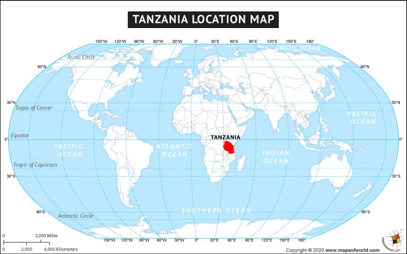
The country of Tanzania is in the Africa continent and the latitude and longitude for the country are 5.6944° S, 36.3223° E.
The neighboring countries of Tanzania are :
- Burundi
- Democratic Republic of the Congo
- Malawi
- Rwanda
- Uganda
- Zambia
Maritime Boundaries
- Comoros
- Seychelles
Facts About Tanzania |
| Country Name | Tanzania |
|---|---|
| Continent | Africa |
| Capital | Dodoma |
| Largest city | Dar es Salaam |
| Area | 947,303 km2 (365,756 sq mi) Water (%) 6.4 |
| Population | 50.76 million (2014 estimate) |
| Lat Long | 6° 18′ 25.2″ S, 34° 51′ 14.4″ E |
| Official Language | Swahili, English |
| Calling Code | +255 |
| Time Zone | EAT (UTC+3) Summer (DST) not observed (UTC+3) |
| Airport | 26 Airports |
| Neighbour countries | Kenya, Uganda, Burundi, Democratic Republic of the Congo, Zambia, Mozambique, Rwanda, Malawi |
| Internet TLD | .tz |
| Currency | Tanzanian shilling (TZS) |

 Tanzania Independence Day