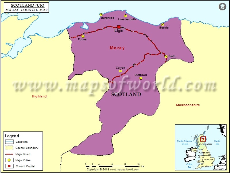
Moray Council, Scotland
Created in the year 1996, Moray is one of the 32 council areas of Scotland. The council area came into existence through the Local Government etc. (Scotland) Act 1994. Shaped within the borders of the Moray district that previously existed, it is located on the northeastern side of the country. The Moray council area shares its borders with Highland and Aberdeenshire and has Moray Firth as its coastline. The Moray Council is governed by the Independent/Conservative administration with effect from May 2007. This union continued to exist even after the 2012 election. Independent councilor for Keith, Stewart Cree was selected as its council convener and now in 2022, the Council is governed by the Conservative group alongside two Independents.
In the House of Commons, the Moray council area is under the constituency of Moray (Westminster). In the Scottish Parliament, most of the area is enclosed within the Moray (Holyrood) constituency.
The Moray Council area is spread over a total area of 864 square miles and as per the estimate of 2022, it has a population of 95,520. The council has around 45 primary and secondary schools and at present runs around 15 public libraries.
Cities in Moray Council |
|||
| Council | City | Latitude | Longitude |
|---|---|---|---|
| Moray | Dufftown | 57.43 | -3.13 |
| Moray | Carron | 57.457261 | -3.300047 |
| Moray | Keith | 57.53 | -2.93 |
| Moray | Forres | 57.6 | -3.62 |
| Moray | Buckie | 57.67 | -2.97 |
| Moray | Lossiemouth | 57.7 | -3.28 |
| Moray | Burghead | 57.7 | -3.48 |
