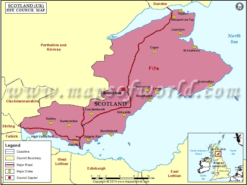
Located between the Firth of Tay and the Firth of Forth, Fife is not only recognized as a historic county of Scotland but also as its council area. Fife was formerly a significant Pictish kingdom. It is still referred to as the Kingdom of Fife within the country of Scotland. Today, Fife is ranked third in the list of the largest local authority areas in terms of its population.
Fife belongs to the lieutenancy area and until the year 1975, it was a county of Scotland. As a region of the local government, Fife is commonly divided into three districts: North-East Fife, Dunfermline, and Kirkcaldy. The unitary Fife Council has been carrying out the functions of the district councils since the year 1996.
The headquarters of Fife Council is located at Glenrothes, which also houses the Administrative Capital of Fife. Since the 2012 elections, Fife was run by the Labour Party. The elected leader of Fife Council was Alex Rowley but after his resignation, David Ross became its leader in February 2014. Steven Grimmond is the Chief Executive of Fife Council.
Cities in Fife Council |
|||
| Council | City | Latitude | Longitude |
|---|---|---|---|
| Fife | Rosyth | 56.03 | -3.43 |
| Fife | Dalgety Bay | 56.038227 | -3.358755 |
| Fife | Burntisland | 56.05 | -3.23 |
| Fife | High Valleyfield | 56.05 | -3.6 |
| Fife | Dunfermline | 56.08 | -3.47 |
| Fife | Oakley | 56.084616 | -3.568547 |
| Fife | Kirkcaldy | 56.12 | -3.17 |
| Fife | Cowdenbeath | 56.12 | -3.35 |
| Fife | Buckhaven | 56.17 | -3.03 |
| Fife | Leven | 56.195594 | -2.994304 |
| Fife | Kennoway | 56.2 | -3.05 |
| Fife | Anstruther | 56.22 | -2.7 |
| Fife | Cupar | 56.32 | -3.02 |
| Fife | St Andrews | 56.33817 | -2.799139 |
| Fife | Leuchars | 56.38 | -2.88 |
| Fife | Newport-on-Tay | 56.43 | -2.92 |
| Fife | Tayport | 56.45 | -2.88 |
