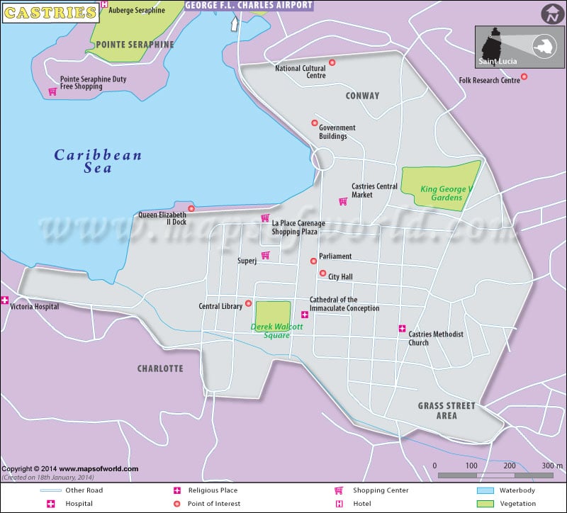
Castries Map – Explore the map of Castries, the Capital of Saint Lucia to locate hotels, shopping centers, tourist attractions, museums, airports, etc.
Castries Map
Castries Map shows tourist attractions, hotels, airports, museums, etc. Castries is the capital and largest city of St Lucia, an island country in the Caribbean.The city is laid out in a grid pattern. It houses duty-free shopping facilities.

 Saint Lucia Facts