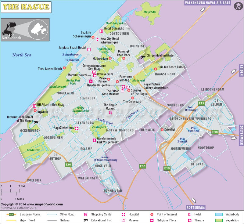
The Hague Map – The Hague city is a government seat in the Netherlands, and the capital city of the province of South Holland.
The Hague Map – The Hague city is a government seat in the Netherlands, and the capital city of the province of South Holland.

Description : The Hague map showing the shopping centers, hospitals, hotels, roads, rails, museums, theaters, etc.
1.3K
previous post