Facts about Netherlands Antilles |
| Netherlands Antilles Island | Territory of Netherlands |
| Coordinates | |
| Location | Caribbean |
| Capital | Willemstad |
| Area | 800 km² (309 sq mi) |
| Population | 175,653 (2001) |
| Official language | Dutch,English.Papiamento |
| Currency | Netherlands Antillean guilder |
| Government | Constitutional monarchy |
| Time zone | (UTC-04:00) |
| Dialing code: | +599 |
| Internet TLD | .an |
Netherlands Antilles
According to the reports of 2010, the Netherlands Antilles don’t exist any more.
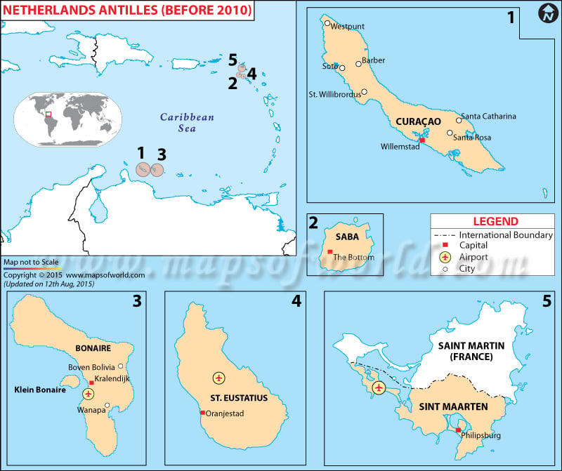
The Netherlands Antilles were also known as the Dutch Antilles. It was referred to as an independent Caribbean country within Netherlands. It’s true that the country has been dissolved of late, but then even today its constituent islands remain an integral part of the Netherlands Kingdom, and under another legal status. The Netherlands Antilles comprise two island groups. The Curacao, Bonaire, and the ABC Islands of the southern Caribbean Sea fall under the first category. In the second group, we have The SSS islands of Sint Maarten, Saba, and Sint Eustatius belonging to the Leeward Islands. In the 17thcentury, these islands were colonized by the Dutch.
Geography
The island groups that made Netherlands Antilles were the Leeward Islands and the Windward Islands. The Windward Islands are noted for their volcanic origin and there’s basically no ground for agriculture. On the other hand, the Leeward Islands are noted for having a mixed blend of coral and volcanic origin.
Weather
The Netherlands Antilles enjoyed a tropical climate and had a warm weather across the year. Hurricanes were common during summers in the Windward Islands. On the other hand, during summers the Leeward Islands were drier and warmer.
