- Continent And Regions - Europe Map
- Other Malta Maps - Malta Map, Malta Blank Map, Malta Road Map, Malta Cities Map, Malta Political Map, Malta Physical Map, Malta Flag
About Malta :
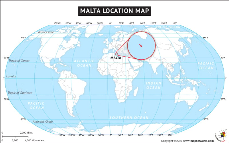
Officially known as the Republic of Malta, it is a Southern European island country which comprises an archipelago in the Mediterranean Sea. Malta is located 284 km (176 mi) east of Tunisia, 333 km (207 mi) north of Libya and 80 km (50 mi) south of Italy. The latitude and longitude for the country are 35.8997° N, 14.5172° E. The total area covered by the country is 316 km2 (122 sq mi) with a population of 450,000. The capital of Malta is Valletta. The official languages of this country are English and Maltese. The average temperature is 23 °C (73 °F) during the day and 16 °C (61 °F) at night.
There are two larger urban areas in Malta, Valletta and Gozo. According to International Monetary Fund (IMF), this country is classified as an advanced economy. The country is a renowned tourist destination as it witnesses at least 1.6 million tourists per year.
Maritime Boundaries
- Italy
- Libya
Facts About Malta |
| Country Name | Malta |
|---|---|
| Continent | Europe |
| Capital | Valletta |
| Largest city | Birkirkara |
| Area | 316 km2 (122 sq mi ) Water (%) 0.001 |
| Population | 446,547 (2013 Est.) |
| Lat Long | 35° 53′ 0″ N, 14° 30′ 0″ E |
| Official Language | Maltese, English |
| Calling Code | +356 |
| Time Zone | CET (UTC+1) Summer (DST) CEST (UTC+2) |
| Airport | 2 Airports |
| Neighbour countries | Tunisia, Libya, Italy |
| Internet TLD | .mt |
| Currency | Euro |

 Science and Technology Malta