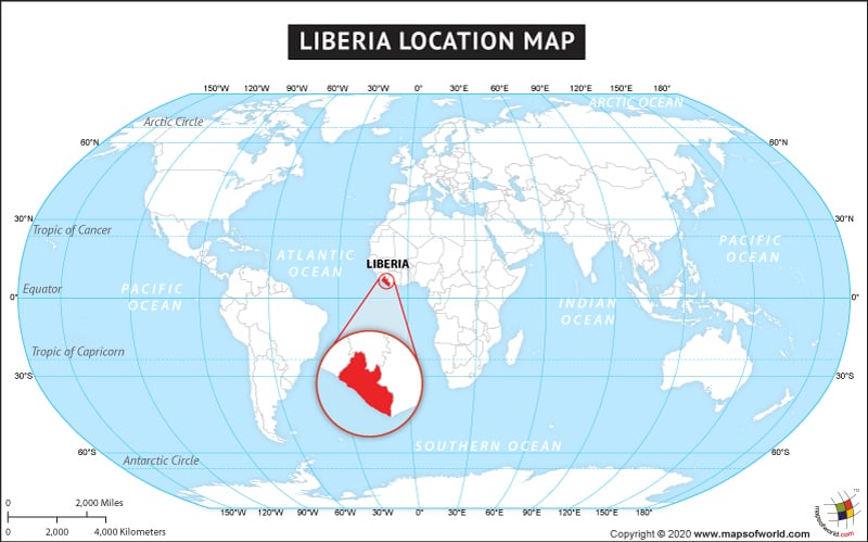
- Neighboring Countries - Sierra Leone, Guinea, Cote d'Ivoire
- Continent And Regions - Africa Map
- Other Liberia Maps - Liberia Map, Liberia Blank Map, Liberia Road Map, Liberia Rail Map, Liberia River Map, Liberia Cities Map, Liberia Political Map, Liberia Flag
The country of Liberia is in the Africa continent and the latitude and longitude for the country are 6.3636° N, 9.4659° W.
The neighboring countries of Liberia are :
- Guinea
Facts About Liberia |
| Country Name | Liberia |
|---|---|
| Continent | Africa |
| Capital and largest city | Monrovia |
| Area | 111,369 km2 (43,000 sq mi) |
| Population | 4,396,873 (2015 estimate) |
| Lat Long | 6.3167° N, 10.8000° W |
| Official Language | English |
| Calling Code | +231 |
| Time Zone | GMT Summer (DST) not observed (UTC) |
| Airport | 1-Airport Scheduled Service |
| Neighbour Countries | Sierra Leone, Guinea, Ivory Coast |
| Internet TLD | .lr |
| Currency | Liberian dollara (LRD) |

 Liberia Facts