- Continent And Regions - Oceania Map
- Other Kiribati Maps - Kiribati Map, Kiribati Blank Map, Kiribati Flag
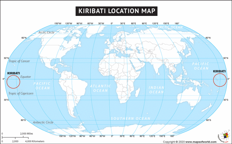
The country of Kiribati is in the Oceania continent and the latitude and longitude for the country are 1.3333° N, 173.0000° E.
The neighboring countries of Kiribati are:
Maritime Boundaries
- Marshall Islands
- Nauru
- Cook Islands
- French Polynesia
- Howland Island
- Jarvis Island
- Kingman Reef
- Tokelau
Facts About Kiribati |
| Country Name | Kiribati |
|---|---|
| Continent | Oceania |
| Capital and largest city | Tarawa |
| Area | 811 km2 (313 sq mi) |
| Population | 103,500 (2010 Est.) |
| Lat Long | 1.4667° N, 173.0333° E |
| Official Language | English, Gilbertese |
| Calling Code | +686 |
| Time Zone | (UTC+12, +13, +14) |
| Airport | Total – 23 airports, 21 are recognized, international airports-2 and 16 provide scheduled domestic airline service. |
| Neighbour Countries | Marshall Islands, Nauru, Cook Islands, French Polynesia, Howland Island, Jarvis Island, Kingman Reef, Tokelau |
| Internet TLD | .ki |
| Currency | Kiribati dollar Australian dollar (AUD) |

 Weather of Kiribati