- Iran Cities - Tehran
- Neighboring Countries - Iraq, Afghanistan, Azerbaijan, Turkmenistan, Pakistan
- Continent And Regions - Asia Map
- Other Iran Maps - Iran Map, Iran Blank Map, Iran Road Map, Iran Rail Map, Iran River Map, Iran Political Map, Iran Physical Map, Iran Flag
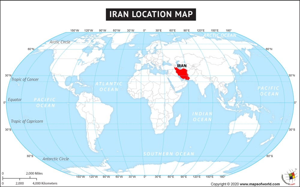
Iran, formally the Islamic Republic of Iran is located in Western Asia and bordered by countries like Afghanistan and Pakistan in the east, Turkmenistan in the north, Iraq in the west, and Armenia, Turkey, and Azerbaijan in the northwest. In the south, it is bounded by the Gulf of Oman and the Persian Gulf. The Caspian Sea borders the country in the north. Iran is the eighteenth largest country in the world with a total area of 1,648,195 sq. km. It has a 2240 km long coastline. The Geographic Coordinates of the country are 32 00N and 53 00 E. Tehran, its capital city is also the largest city in the country.
Iran has mostly an arid and semi-arid climate. Iran is a multicultural country with widely diverse ethnic groups. Iran’s oil reserve makes it an upper-middle-income group country. The tourism sector in Iran though gets impacted by its war with neighboring Iraq, the country’s vast wildlife and mesmerizing natural landscape have a lot to offer to its visitors.

 Iran Facts