- Indonesia Provinces - Aceh, Bali, Bangka-Belitung, Banten, Bengkulu, Gorontalo, Jakarta Raya, Jambi, Jawa Barat, Jawa Tengah, Jawa Timur, Kalimantan Barat, Kalimantan Selatan, Kalimantan Tengah, Kalimantan Timur, Kalimantan Utara, Kepulauan Riau, Lampung, Maluku Utara, Maluku, Nusa Tenggara Barat, Nusa Tenggara Timur, Papua, Riau, Sulawesi Barat, Sulawesi Selatan, Sulawesi Tengah, Sulawesi Tenggara, Sulawesi Utara, Sumatera Barat, Sumatera Selatan, Sumatera Utara, West Papua, Yogyakarta
- Neighboring Countries - Singapore, Malaysia, Papua New Guinea, Australia
- Continent And Regions - Asia Map
- Other Indonesia Maps - Indonesia Map, Indonesia Blank Map, Indonesia Road Map, Indonesia Rail Map, Indonesia River Map, Indonesia Cities Map, Indonesia Political Map, Indonesia Physical Map, Indonesia Flag
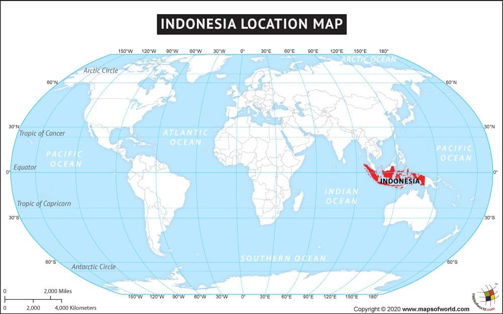
The country of Indonesia is in the Asia continent and the latitude and longitude for the country are 3.2591° S, 109.7028° E.
The neighboring countries of Indonesia are:
Maritime Boundaries
- Australia
- India
- Palau
- Philippines
- Singapore
- Thailand
- Vietnam
- Ashmore and Cartier Islands
- Christmas Island
Facts About Indonesia |
|---|
| Country Name | Indonesia |
|---|---|
| Continent | Asia |
| Capital and largest city | Jakarta |
| Area | 1,904,569 km2 (735,358 sq mi ) Water (%) 4.85 |
| Population | 275 million estimated |
| Lat Long of Indonesia | -0.660104, 113.884004 |
| Official Language | Indonesian |
| Calling Code | +62 |
| Time Zone | various (UTCGMT+7 GMT+9) Summer (DST) GMT 7- GMT 9 (UTC) |
| Airports in Indonesia | more than 230 airports |
| Neighbor countries | Papua New Guinea, East Timor, Malaysia, Singapore, the Philippines, Australia |
| Internet TLD | .id |
| Currency | Indonesian rupiah (Rp) (IDR) |
