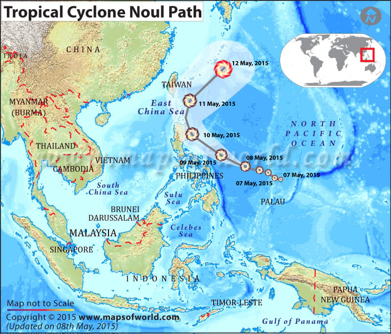
Philippines braces for Typhoon Noul; landslides, flash floods feared
As Typhoon Noul closes in on Philippines, the authorities are preparing for pre-emptive evacuations.
Thousands of people have been evacuated in the north-eastern and central Philippines and brought to safer regions as the typhoon is expected to hit the country late Saturday or early Sunday before heading towards Japan.
It has been forecast that northeastern part of Luzon will bear the maximum brunt of the category-four storm that might lead to 200 mm of rain. Typhoon Noul is likely to trigger landslides and flash floods. Moreover, it could wreak havoc near volcano (Mount Bulusan) as the heavy rain from the typhoon could cause flows of mud and debris.
Noul has already caused heavy rain in the island of Yap in Micronesia on May 6. Philippines, which witnesses 20 typhoons a year on an average, was battered by Super typhoon Haiyan in 2013 that left over 8,000 people dead or injured.

 Hurricane Gustav & Tropical Storm Hanna