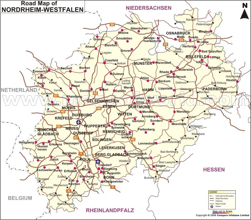
The road map of Nordrhein-Westfalen represents highways and major roads in the state. It includes main roads, state roads, district roads, and major cities and towns of Nordrhein-Westfalen.
Nordrhein-Westfalen Road Map
The road network in Nordrhein Westfalen is extensive that includes the Main roads, State roads, and District roads. They connect the major cities and towns of Nordrhein-Westfalen.
