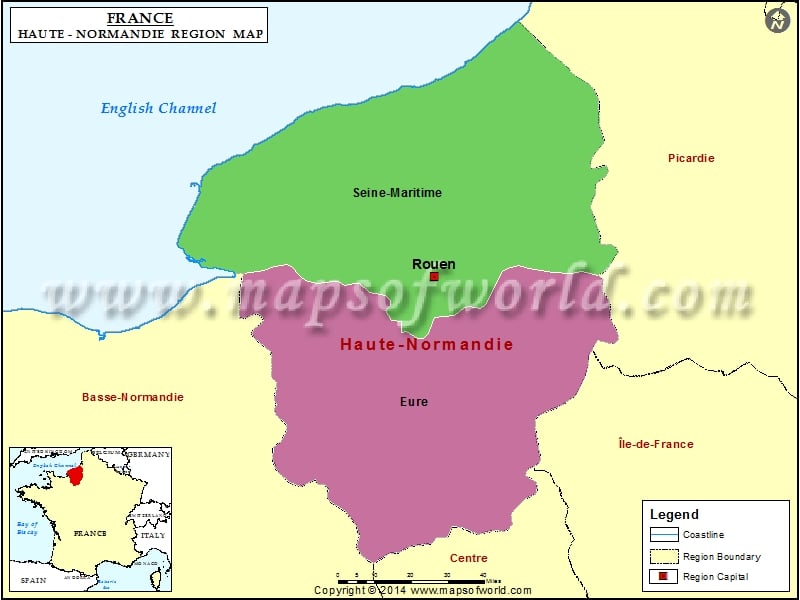
Upper Normandy (Haute-Normandie) Map

View detailed world maps that offer a global perspective—political, physical, and more.
Explore maps that visualize data on topics like population, climate, economy, and beyond.
Navigate the world with maps that guide your journeys—country and city maps for travelers.
Learn, discover, and share with educational maps, geography trivia, and cartographic insights—ideal for classrooms and curious minds.
FBrowse quick-reference lists for airports, area codes, capitals, postal codes, time zones, and more—organized for easy access.
Explore powerful mapping tools and services.
Order custom maps tailored to your most specific needs, whether for business, education, travel, or more!
Learn moreView detailed world maps that offer a global perspective—political, physical, and more.
Explore maps that visualize data on topics like population, climate, economy, and beyond.
Navigate the world with maps that guide your journeys—country and city maps for travelers.
Learn, discover, and share with educational maps, geography trivia, and cartographic insights—ideal for classrooms and curious minds.
FBrowse quick-reference lists for airports, area codes, capitals, postal codes, time zones, and more—organized for easy access.
Explore powerful mapping tools and services.

Haute Normandie is one of the 26 regions of France. This region was created in 1956, when Normandy was divided into two divisions namely Basse – Normandie and Haute – Normandie.
The capital of Haute – Normandie region is Rouen. Rouen is home to many beautifull churches and buildings. Rouen is known for it’s cathedral highest in France. The region has two departments namely Eure and Seine-Maritime. The region is divided into 6 arrondissements, 112 cantons and 1,420 communes. The total land area covered by the region is 12,318 km2.
After the German invasion in 1940, Normandy had an important role to play. On June 6, 1944, the coast was the setting for D-Day.
From the harbors of Normandy, there’s a huge supply of fresh and prepared fish and shellfish. A popular dish is the marmite dieppoise that is made up of fresh scallops, mussels and fish shine. Other catch from the sea includes Oysters, clams, lobsters and shrimp. Turbot, hake, skate and sole are also available at the Normandy coast.
Cidre is a popular beverage. It’s a fermented apple juice that has been made since the Middle Ages. Another beverage of Normandy is poire, a fermented pear juice. Calvados or Calva and Bénédictine are other beverages of the region.
Upper Normandy (Haute-Normandie) Railway Map shows the railway lines, major roads, the regional boundary, and the region’s capital.
Upper Normandy (Haute-Normandie) Road Map shows the major roads, highways major towns, the regional boundary, and the region’s capital.
We rely on ads to keep creating quality content for you to enjoy for free.
Please support our site by disabling your ad blocker.
If the prompt is still appearing, please disable any tools or services you are using that block internet ads (e.g. DNS Servers).