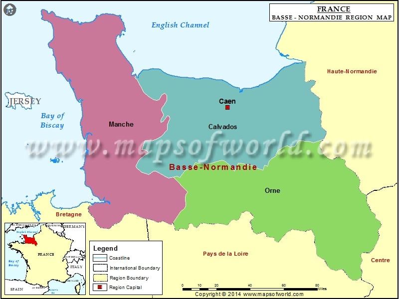
Lower Normandy (Basse-Normandie) Map

View detailed world maps that offer a global perspective—political, physical, and more.
Explore maps that visualize data on topics like population, climate, economy, and beyond.
Navigate the world with maps that guide your journeys—country and city maps for travelers.
Learn, discover, and share with educational maps, geography trivia, and cartographic insights—ideal for classrooms and curious minds.
FBrowse quick-reference lists for airports, area codes, capitals, postal codes, time zones, and more—organized for easy access.
Explore powerful mapping tools and services.
Order custom maps tailored to your most specific needs, whether for business, education, travel, or more!
Learn moreView detailed world maps that offer a global perspective—political, physical, and more.
Explore maps that visualize data on topics like population, climate, economy, and beyond.
Navigate the world with maps that guide your journeys—country and city maps for travelers.
Learn, discover, and share with educational maps, geography trivia, and cartographic insights—ideal for classrooms and curious minds.
FBrowse quick-reference lists for airports, area codes, capitals, postal codes, time zones, and more—organized for easy access.
Explore powerful mapping tools and services.

The French Metropolitan Region, Basse-Normandie was created in 1956. It came into existence after Normandy region was divided into Basse-Normandie and Haute-Normandie. Basse-Normandie means lower Normandie.
The three departments of this French Metropolitan Region are Calvados, Manche and Orne. The total area covered by Basse- Normandie Region is about 10,857 square miles. The capital of this region is Caen.
The economy of this region is primarily agricultural. The major industries of the region include livestock and dairy farming, textiles and fruit production. Another major industry of Basse – Normandie region is Tourism. The region has direct ferry links to England.
This region suffered badly during World War II. There was tremendous destruction during the Battle of Normandy.
The three main departments of Basse-Normandie are Calvados, Manche and Orne. The region has 11 arrondissements, 141 Cantons and 1,812 Communes. The total land area covered by Basse – Normandie is 17,589 square kilometres.
During the Roman era, Basse – Normandie was divided into a number of different city-states. The Franks conquered this region in the 5th century. The Normans devastated the region in the 9th century. During World War II, Operation Overlord’s main thrust was focused on Basse-Normandie.
In Basse – Normandie, the regional language spoken is the Norman language. The most evident dialect spoken here is Cotentin. This region has been home to many well-known authors such as Guy de Maupassant, Jules Barbey d’Aurevilly, Marcel Proust and Gustave Flaubert. Alfred Rossel and Louis Beuve are some notable Norman language authors. Music composer Erik Satie was also from Basse – Normandie region.
Lower Normandy (Basse-Normandie) Railway Map showing the railway lines, major towns, the regional boundary, and the regional capital.
Lower Normandy (Basse-Normandie) Road Map shows the major roads, highways, major towns, the regional boundary, and the regional capital.
We rely on ads to keep creating quality content for you to enjoy for free.
Please support our site by disabling your ad blocker.
If the prompt is still appearing, please disable any tools or services you are using that block internet ads (e.g. DNS Servers).