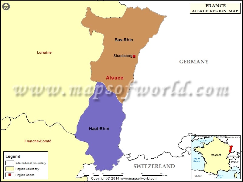
Alsace Map

ALSACE
Alsace is a French Metropolitan Region. It is one of the 26 French regions. Alsace is situated on the eastern border of France. It’s located adjacent to Germany and Switzerland. This French Metropolitan Region was earlier a part of the Holy Roman Empire.
Till present day, you will find, people who speak Upper German dialect. During the 17th century, the region was put under French sovereignty. Thus, it became one of the French provinces.
The capital and largest city of France is Strasbourg. Alsace is referred in conjunction with Lorraine. The territory of Alsace-Lorraine was disputed between France and Germany. The region is currently a part of France. It has been a part since World War II.
GEOGRAPHY OF ALSACE
The French Metropolitan Region, Alsace covers an area of 8283 km2. Infact France is the smallest region of metropolitan France. The departments of Haut-Rhin and Bas-Rhin are a part of Alsace. The region of Alsace has many forests and valleys. The ballon de Guebwiller in Haut-Rhin is the highest point of Alsace region. In Alsace region, a semi-continental climate prevails.
HISTORY OF ALSACE
In the prehistoric days, nomadic hunters lived in this region. Later Celts settled in the region. Around 58 B.C. Romans settled in the region. In the later years, the Alamanni settled in the region. It was the language of the Alamanni that formed the basis of the present-day Alsatian dialect. Then, Alsace came under Frankish control.
POLITICS IN ALSACE
Alsace is one of the two regions of Metropolitan France. It is one of the two Metropolitan regions where the conservative right won the 2004 regional elections. Alsace is the region that has had a frequently changed status throughout history that has effected modern day politics.
IMPORTANT CITIES OF ALSACE
Some important cities of France are Colmar, Haguenau, Molsheim, Mulhouse, Ribeauville, Saint Louis, Saverne, Selestat, Strasbourg, Thann and Wissembourg.