- France Regions - Limousin, Lower Normandy (Basse-Normandie), Alsace, Aquitaine, Auvergne, Brittany (Bretagne), Burgundy (Bourgogne), Champagne-Ardenne, Franche-Comte, Ile de France, Languedoc-Roussillon, Lorraine, Midi-Pyrénées, Nord-Pas-de-Calais, Picardie, Rhône-Alpes, Pays de la Loire, Poitou-Charentes, Provence-Alpes-Côte d'Azur, Upper Normandy (Haute-Normandie)
- Neighboring Countries - Luxembourg, Monaco, Andorra, Belgium, Switzerland
- Continent And Regions - Europe Map
- Other France Maps - France Map, Where is France, France Blank Map, France Road Map, France River Map, France Cities Map, France Political Map, France Physical Map, France Flag
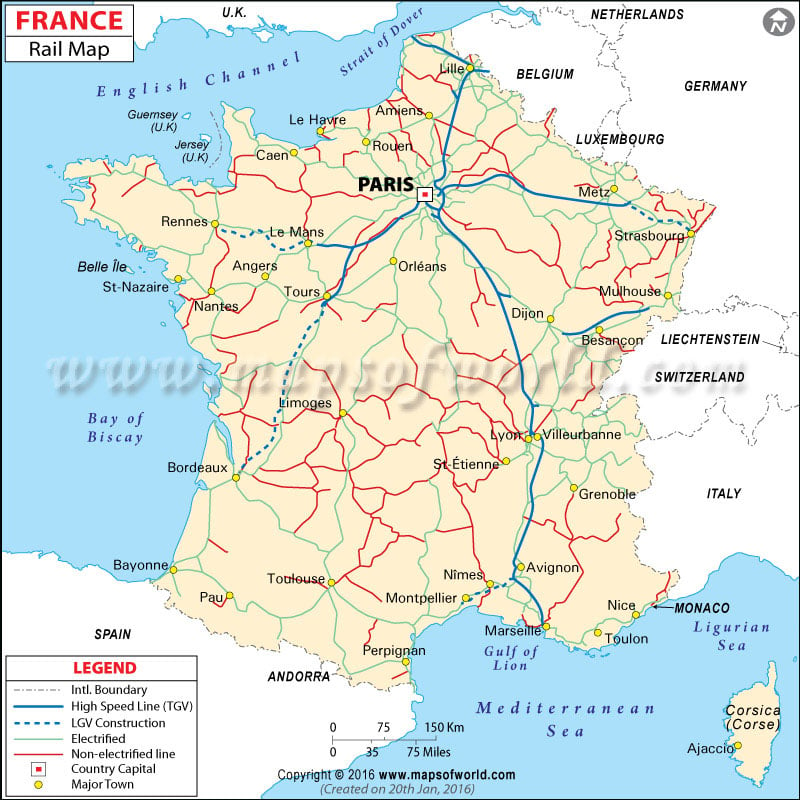
The France rail map shows the rail network of France, and find different railway zones and major cities’ railway line.
