- Continent And Regions - Oceania Map
- Other Fiji Maps - Fiji Map, Where is Fiji, Fiji Blank Map, Fiji Road Map, Fiji Rail Map, Fiji River Map, Fiji Political Map, Fiji Physical Map, Fiji Flag
The Republic of Fiji is an island nation in Melanesia in the South Pacific Ocean. The total area covered by the country is 7,056 square miles and the republic is home to an estimated population is 849,000.
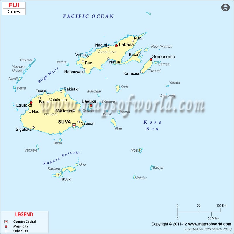
As shown in the Fiji Cities Map, the island nation’s closest neighbors are Vanuatu, New Caledonia, Kermadec, Tonga, the Samoas, France’s Wallis and Futuna, and Tuvalu .
The Republic of Fiji is composed of 322 islands among which Viti Levu and Vanua Levu are the two major islands. Suva is the capital of Fiji and is located on the southeast coast of the island of Viti Levu. Suva is home to almost half of the nation’s entire population. Suva has an area of 790.5 square miles and an estimated population of 85,691.
For administrative purposes, Fiji is divided into four major divisions which are further divided into fourteen provinces. The fourteen provinces are:
Ba, Bua, Cakaudrove, Kadavu, Lau, Lomaiviti Province, Macuata, Nadroga-Navosa, Naitasiri, Namosi, Ra, Rewa, Serua, and Tailevu. The governance of Fiji takes place within the framework of a military appointed government and a Parliamentary Republic. The President is the head of state while the Prime Minister functions as the head of government. President Epeli Nailatikau currently heads the state and the Prime Minister of the nation is Frank Bainimarama.
Fiji saw a period of rapid growth in 1960s and 1970s but economic growth slowed down in the 1980s. Urbanization and expansion in service sector has contributed to GDP growth. Sugar export and the tourism industry are major sources of foreign exchange.

 Fiji History