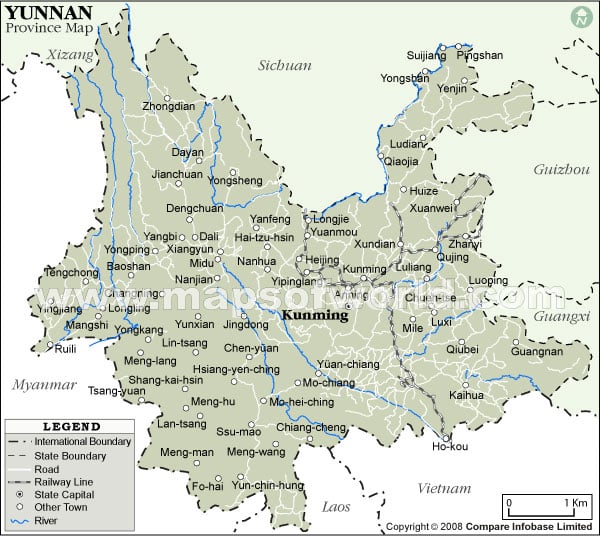
Map of Yunnan Province

Yunnan is a province of the People’s Republic of China which is located in the southwestern corner of the country of China. The capital of this region is Kunming.
Yunnan province of the People’s Republic of China covers an area of 394,000 square km. Yunnan shares a border of 4,060 km with Myanmar in the west, Laos in the south, and Vietnam in the southeast.
Yunnan has enough rainfall and many rivers and lakes. The rich water possessions offer plentiful hydro-energy. This region is drained by six major rivers. Namely:
- Jinsha Jiang the River of Golden Sands drains the northern side of the region,
- Pearl River, drains the eastern side of the region
- Mekong
- The Red River which is also known as Yuan
- Salween
- The Irrawaddy
Yunnan in China has plentiful natural resources. It is also popular as the kingdom of plants, animals and home of non-ferrous metals and medicinal herbs. More than 150 kinds of minerals have been already discovered in the province. Yunnan ranks first in China in deposits of
- Zinc
- Lead
- Tin
- Cadmium
- Indium
- Thallium
- Crocidolite
Yunnan is attractive with its rich tourism assets, including beautiful landscape, and a pleasant climate. Tourist spots in Yunnan include:
- Dali: This is a historic center of the Nanzhao and Dali kingdoms.
- Jinghong: It is the capital of the Xishuangbanna Dai minority autonomous region.
- Lijiang: It is a Naxi minority city.
- Shangri-La County: It is an ethnic Tibetan township and county.
- The Stone Forest:
- Yuanyang: It is a Hani minority settlement.
Yunnan is famous for its very high level of ethnic diversity. It has the highest number of ethnic groups in all provinces and autonomous regions in China. Here you can find numbers of minority groups, such as:
|
|
Yunnan’s ethnic diversity is reflected in its linguistic diversity too. Languages spoken in Yunnan include some Tibeto-Burman languages such as:
|
|