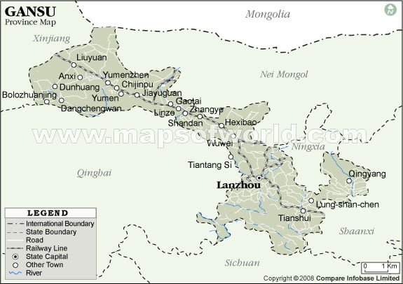
Gansu Province Map

The Gansu province was established in 1271-1368, during the reign of Yuan Dynasty. It is believed that Gansu derived its name from the first characters of the names of its two ancient cities Ganzhou and Suzhou.
The Gansu province is considered to be the birth place of the Chinese culture. According to the archaeological surveys the Yangshou Culture came into existence around 6000 years ago in the Gansu province.
The Gansu province has a sundry landscape. It is a congregation the three plateaus namely the Loess Plateau, the Qinghai-Tibet Plateau and the Inner Mongolian Plateau and is surrounded by Shaanxi in the east, Sichuan in the south, Qinghai and Xinjiang in the west, Ningxia and Inner Mongolia in the north. The Hexi Corridor that covers the area of the ancient Silk Road is located on the northwestern part of Gansu and the Gobi desert is spread sporadically over Gansu.
The climate of Gansu is temperate monsoonal but it has the typical characteristics of the continental climate. The average annual temperature of Gansu is 9 o C. The hottest month of July receives an average temperature of 20 o C-24 o C and January being the coldest month receives an average temperature of -12 o C -2 o C approximately. The average annual rainfall is marked as 50-800 mm approximately.
Gansu comprises of 6 district level cities, 6 districts, 2 autonomous districts, 9 county-level cities, 60 counties and 7 autonomous counties. Dunhuang and Jiayuguan are the major cities of Gansu. Gansu is quite famous for its grotto art.
Wheat, maize, millet, cotton linseed, melons and various other fruits are the main agricultural products of the region. Its main cattle comprises of pigs, sheep, cattle and horses.
Gansu has more than 60 types of minerals from which nickel is the most famous and Jinchang is the major nickel producing industry. The famous and huge fields of Gansu include Yumen and Chongqing. Tianshui is the industrial center of Gansu.