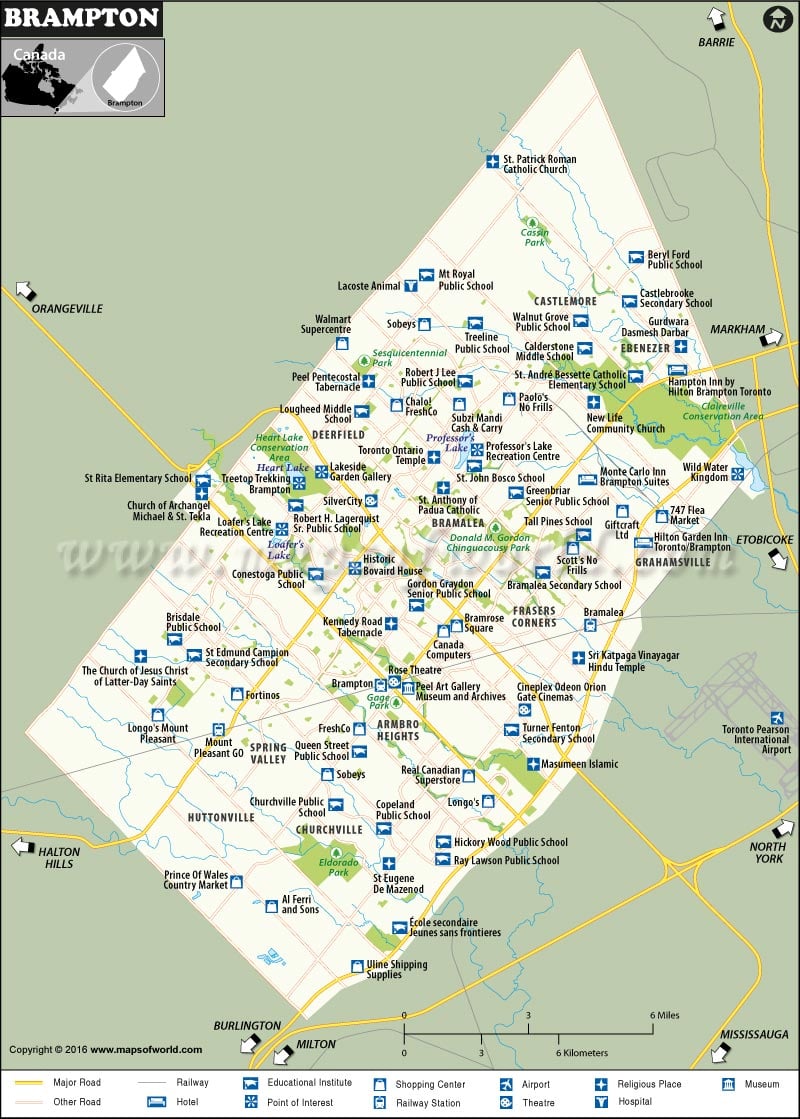
Brampton is a city in the province of Ontario in Canada. Nicknamed “Flower City,” it is a part of the Greater Toronto Area (GTA) and Peel Region’s seat. The city was officially incorporated in 1974 and you can check Brampton Area Codes here.
How to Reach Brampton
Toronto Pearson International Airport (CYYZ), Canada’s busiest airport, is minutes from the city.
Canadian National Railways and Orangeville-Brampton Railway run through Brampton.
Highway 401, 410, and 407 are major thoroughfares in the city.
Best Time to Visit Brampton
Brampton in spring and fall comes alive with pedestrian marketplaces and numerous cultural events. For those who can brace for Canadian winters and want cheaper deals on hotels & flights, winter is the best time.
Things to Do in Brampton
The Peel Art Gallery, Museum, and Archives (PAMA) exhibits approximately 12,000 artifacts of historical and cultural significance. The Great War Flying Museum at Brampton Airport displays replicas of World War I aircraft. The Rose Theatre is a famous city landmark that hosts a variety of productions and concerts.
Chinguacousy Park includes modern facilities for multi-season activities like softball leagues in summer and ski lifts in winter. Opened in 1903, Gage Park features floral gardens, a gazebo, and trails for rollerblading & jogging. Though the park is famous as an ice skating destination, it also hosts summer evening concerts. Heart Lake Conservation Area is a popular destination for hiking, swimming, fishing, and boating. The 848 acres of Claireville Conservation Area offer a quiet retreat to nature lovers.
