- Burundi Cities - Bujumbura
- Neighboring Countries - Democratic Republic of the Congo, Rwanda, Tanzania
- Continent And Regions - Africa Map
- Other Burundi Maps - Burundi Map, Where is Burundi, Burundi Blank Map, Burundi Road Map, Burundi Political Map, Burundi Physical Map, Burundi Flag
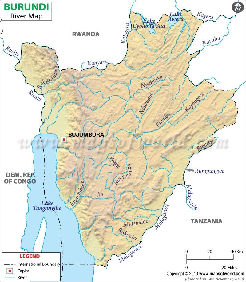
Burundi Rivers form an important part of the geographical features of the landlocked country. The rivers of Burundi serve as natural boundaries dividing Burundi geography from other neighboring countries.
The major Burundi rivers are Ruzizi, Rurubu, Kagera, Muragarazi, Kanyaru, etc.
The rivers of Burundi flow into the river basins of two major Africa rivers, the Nile and the Zaire. The Kagera river and the Ruvubu river form the sources of the Nile, flowing from the southeastern region. Ruzizi river is one of the Burundi rivers flowing into the Zaire river basin.
Some of the Burundi rivers flow into Lake Tanganyika as well like the Doma, Mulembwe, etc. The rivers of Burundi, apart from being sources of water for the country are also utilized for the generation of hydroelectric power. The fast flowing Burundi rivers offer an abundant supply of power if utilized properly as renewable sources of energy.
Burundi |
| River | Length (km) | Length (miles) | Drainage area (km²) | Outflow | Countries in the drainage basin | Burundi Provinces in the drainage basin |
|---|---|---|---|---|---|---|
| Nile River | 6650 | 4132 | 3349000 | Mediterranean Sea | Burundi, Democratic Republic of the Congo, Ethiopia, Sudan, Egypt, Uganda, Kenya, Tanzania, Rwanda, South Sudan | Bururi |
| Kagera River | 400 | 250 | 59700 | Lake Victoria | Burundi, Tanzania, Rwanda, Uganda | Muramvya, Karuji, Mwaro, Gitega |
| Ruvubu River | 480 | 300 | 10547 | Confluence with Kagera River | Burundi, Tanzania | Bujumbura |
| Malagarasi River | 450 | 250 | 130000 | Lake Tanganyika | Burundi, Tanzania | Bujumbura |
| Ruzizi River | 117 | 73 | Data not available | Lake Tanganyika | Burundi, DR Congo (DRC), Rwanda | Bujumbura |

 Burundi Languages