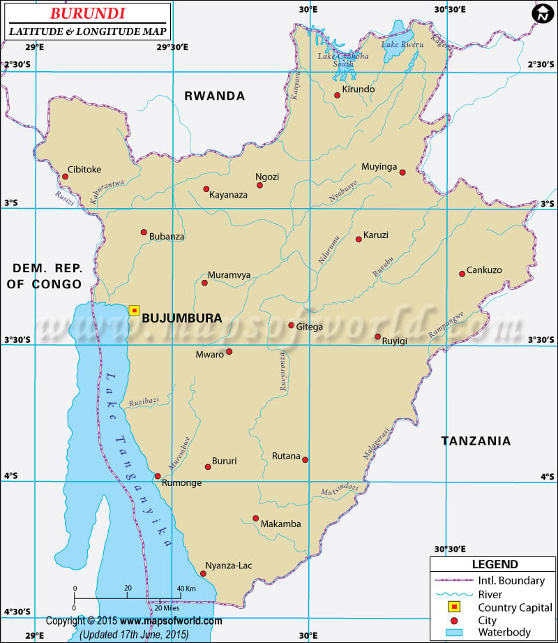
The
Latitude and Longitude of
Burundi is 3° 30 S and 30° 00 E respectively. The specific
latitude and
longitude of Burundi indicates its proximity to the equator and its position in southern hemisphere.
Situated in the eastern region of Democratic Republic of Congo this country occupies more over 27,800 square kilometers of Central Africa. The terrain of Burundi is featured by crags and mountains. Some plain lands are found in the upland region of the eastern part of the country. The altitude of the plateau ranges from 772 miter to 2,670 miter above the sea level.
The latitude and longitude of Burundi contributes a great to its weather. The climatic condition of Burundi is primarily characterized as 'equilateral'. Usually the yearly standard temperature alters from 17 degree centigrade to 23 degree centigrade. The average yearly precipitation of Burundi is approximately 150 centimeter. Bujumbura is the capital of Burundi. It is located at 3° 23' S and 29° 22' E.
Latitude and Longitude of Burundi |
|---|
| Location | Latitude | Longitude |
|---|
| Bubanza | 03°06'S | 29°23'E |
| Bujumbura | 03°16'S | 29°18'E |
| Bururi | 03°57'S | 29°37'E |
| Cankuzo | 03°10'S | 30°31'E |
| Gitega | 03°26'S | 29°56'E |
| Kibumbu | 03°32'S | 29°45'E |
| Kitega/Gitega | 03°26'S | 29°56'E |
| Makamba | 04°08'S | 29°49'E |
| Muyinga | 03°14'S | 30°33'E |
| Ngozi | 02°54'S | 29°50'E |
| Nyanza-Lac | 04°21'S | 29°36'E |
| Rumonge | 3°59'S | 29°26'E |
| Rutana | 3°55'S | 30°0'E |
Last Updated on: November 9th, 2017


