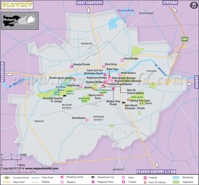
Situated on the banks of the River Maritsa, Plovdiv is the second biggest city of Bulgaria. The city is famous for its diverse culture and rich heritage. Plovdiv is the main administrative city of the Plovdiv province. Plovdiv was initially known as Philippopolis and was inhabited by a large number of people.
The city is the main center of the agriculture region of Thracia. Food processing industries have largely grown over the country. The city is also hub to many textile, chemicals and machinery. A number of industrial complexes have developed in the city thus boosting up the economy of Bulgaria.
The Plovdiv city is well connected with the country through a good network of rail-road system. There are three bus terminals along with train stations. Over time, it has become one of the most important tourist destinations. The Plovdiv International Airport is very near to the village Krumovo, lying southeast of Plovdiv.
The city has a huge number of archaeological sites namely, Roman Theatre and Stadium, Bulgarian National Revival and others. A large collection of Bulgarian artifacts are preserved in the Plovdiv Museums including Archaeological Museum, the Ethnographic Museum, the Natural Museum, the Historical Museum and the City Art Gallery. This Bulgarian city houses a number temples, mosques and churches. There are many Baptist, Presbyterian and protestant churches in the city.
Plovdiv has several tourist attractions. Some of these include:
- The Old Town
- Eirene mosaic
- Nebet Tepe hill complex
- Dzhumaya Mosque
- Ancient synagogue
- St. Constantine and Helena Church
- Sahat Tepe hill and clock tower
