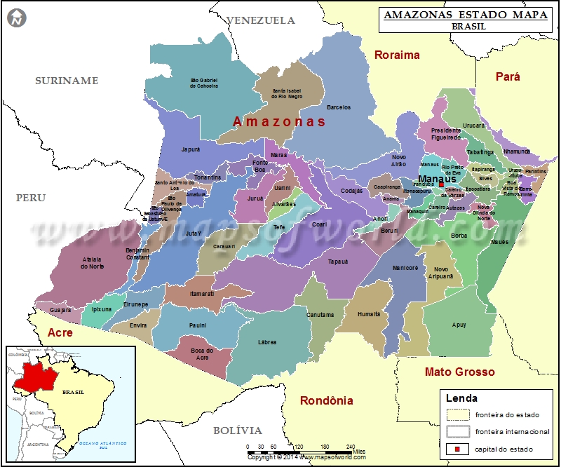
Amazonas Mapa

Facts about Amazonas State of Brazil |
|
|---|---|
| Country | Brazil |
| Capital | Manaus |
| Area | 1,570,745.7 sq km |
| Population | 3,807,923 (est. 2013) |
| Demonym | Amazonense |
| Time zone | UTC-4 (UTC-03), DST (UTC-02) |
| Postal Code | 69000-000 to 69290-000, 69400-000 to 69890-000 |
| Airports | Eduardo Gomes International Airport |
The largest State of Brazil, Amazonas is located in the Northern part of the country. Amazonas, one of the most important State of Brazil is surrounded by Roraima, Para, Mato Grosso, Rondonia, Acre, Peru, Colombia and Venezuela.
Like many other States of Brazil, the territory of Amazonas is mostly covered by Rain forest. Named after the River Amazon, the State of Amazonas is a home to the highest mountain in Brazil; Pico da Neblina. The Pico da Neblina is a tepui and it stands at 2,994 meters above sea level. The Rain Forest of Amazonas is divided into three sub divisions, they are:
Igapos: This is permanently flooded land where the roots of vegetations are almost always submerged. Varzeas: This part of the State is higher than the Igapos and therefore, naturally, is only submerged in the wet seasons when the volume of the water in the river rises. Low plateau: This part is even higher than the Varzeas and therefore never submerged.
The State of Amazonas has many important cities which include:
- Manaus
- Itacoatiara
- Manacapuru
- Parintins
- Tefe
- Coari
- Sao
- Gabriel da Cachoeira
Earlier the economy of Amazonas, like most parts of the Brazilian State was dependent on the export of rubber but today the options have widened and the Economy has diversified. Presently there are different kinds of industries in Amazonas like farming of cassava, oranges, and other agricultural products. The Government of Brazil is pushing harder for the development of the export of consumer goods.
There are also some tourists who love to explore these silent dense Rain forests of the region. This also earns some revenue for the government but that is only a nominal amount.