Djibouti is a country located in the Horn of Africa. The official name of Djibouti is the Republic of Djibouti but it also referred to as Jumhuriyyat Jibuti, Jamhuuriyadda Jabuuti, Republique de Djibouti and Gabuutih Ummuuno.
The total area covered by the country is 8,958 square miles and the estimated population is 906,000.
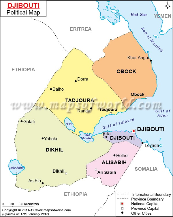
As shown in the political map of Djibouti, the country shares borders with Eritrea to the north, Ethiopia to the west and south, and Somalia to the south-east. The country also borders the Red Sea and the Gulf of Aden to the east.
The Djibouti Political Map shows the national capital, major cities, and other political divisions of the country. The international and provincial borders of Djibouti are also shown.
The national capital, Djibouti city is clearly shown on the map. Covering a total area of 77.2 square miles and home to over 567,000 people, it is the largest city in the Republic of Djibouti.
The other major cities in the country are:
- Dorra
- Balho
- Galafi
- AsEla
- Dikhil
- Obock
- Arta
- Yoboki
- Holhol
Djibouti is divided into five regions and one city. The regions are further divided into districts. The regions are :
- Ali Sabieh Region
- Arta Region
- Dikhil Region
- Obock Region
- Tadjourah Region
The government of Djibouti functions in the framework of a presidential republic. The President is the head of the state while the Prime Minister serves as the head of government. Currently, Ismail Omar Guelleh is the President of the nation while Abdoulkader Kamil Mohamed holds the title of the Prime Minister.
|

