- Continent And Regions - Oceania Map
- Other Vanuatu Maps - Vanuatu Map, Vanuatu Blank Map, Vanuatu Flag
Vanuatu or the Republic of Vanuatu is an island nation located in South Pacific Ocean. Geographically Vanuatu is located in-between the Coral Sea and the South Pacific Sea. Vanuatu, an archipelago consists of close to 82 small sized islands of volcanic origin. 65 out of 82 islands are inhabited.
This irregular Y shaped chain of 82 islands; with a total area of 4,710 sq miles have a total coastline of 1,571 miles. This 500 miles long island chain lies 600 miles to the west of Fiji and 250 miles to the northeast of New Caledonia.
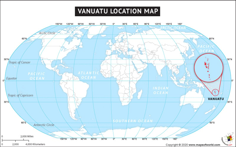
Vanuatu location map indicates the exact location of Vanuatu in the world map. Vanuatu location map shows that the Vanuatu is a part of Oceania and is about three quarters of the way from Hawaii to Australia. Inset on the Vanuatu location map shows the cluster of islands which are a part of Republic of Vanuatu.
The country of Vanuatu is in the Oceania continent and the latitude and longitude for the country are 17.7500° S, 168.3000° E.
The neighboring countries of Vanuatu are :
Maritime Boundaries
- Fiji
- Solomon Islands
- New Caledonia
Facts About Vanuatu |
| Country Name | Vanuatu |
|---|---|
| Continent | Oceania |
| Capital and largest city | Port Vila |
| Area | 12,190 km2 ( 4,710 sq mi) |
| Population | 266,937 ( July 2014 estimate ) |
| Lat Long | -15.247984, 166.908765 |
| Official Language | Bislama, French, English |
| Calling Code | +678 |
| Time Zone | VUT (Vanuatu Time) (UTC+11) |
| Airport | 30 Airports |
| Neighbour countries | Fiji, New Caledonia, Australia, New Zealand, Solomon Islands |
| Internet TLD | .vu |
| Currency | Vanuatu vatu (VUV) |

 Independence Day of Vanuatu