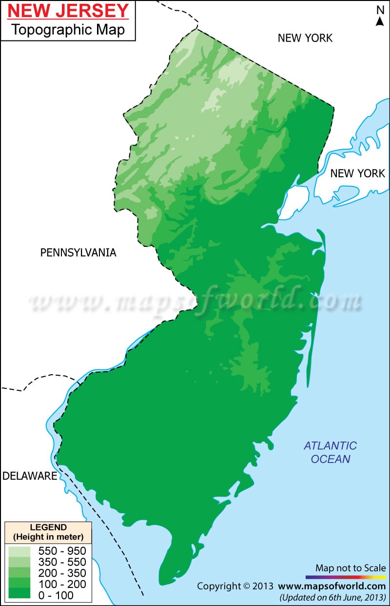
The topography map of New Jersey marks the sandy beaches and swamps that are a part of the Atlantic Coastal Plain. The white oaks and pitch pines of the Pine Barrens spanning over 1968 sq km is another prime element of the Atlantic Coastal Plain. The lakes and rivers are also a major part of the topography of New Jersey. Hudson and Delaware rivers are the main watercourses of New Jersey. Also, Hopatcong lake having a length of 13 km is the largest among the several natural lakes of the state. The New Jersey topographic map is said to offer a vivid overview of all the features of the physiography of the state. The New Jersey state map also provides necessary information about the state’s topography.
New Jersey Topographic Map
Kittatinny Ridge and Valley and Appalachian Valley cover the northwestern part of New Jersey state. Ramapo Mountains, which is an extension of Appalachian Valley, lies on the southern and eastern Highlands of the state of New Jersey. With a height of 1803 ft High Point is the highest elevation of the state, with the lowest elevation at sea level in Atlantic Ocean.
